The "Emery Board" terrain survey technique is named after Kenneth O. Emery, a world renowned coastal scientist and geologist. The original Emery Board method was designed for monitoring changes in shoreline topography and could be performed with just two meter sticks and visible horizon; **This adaptation allows you to perform the Emery Board technique in any landscape with elevation change! ** In essence, this is a quick and inexpensive technique for mapping the slope of a land form. Each data point collected during this survey records the distance between the two emery boards (run) and the amount of elevation change that occurs between the two boards (rise). The run is graphed along the X - axis and the rise along the Y - axis, resulting in a cross section map of the area, like the one below. This technique makes it easy to model when, where, and how much terrain changes over time by making repetitive surveys fast and inexpensive. Emery Board survey data can be used in a variety of ways, including mapping sediment movement on beaches following major storm events and measuring spoil banks along pipeline routes in order to monitor industry's permit compliance. ## Activities [notes:grid:emery-board] [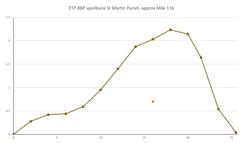](/i/29211) ...