@glennwalquist (who shared the above picture) has been monitoring a sand mine site using a timelapse camera, but says:
I think that any data that approximates the quantity of sand ( in tonnage or some other practical measure ) that is being removed above and beneath the surface of the mining site is really what groups like ourselves (and FracTracker Alliance) are striving to somehow obtain.
I'm curious if volume of sand could be measured using a 3d app like this:
Perhaps using some of the techniques posted by @cfastie and @patcoyle:
But I don't know how much (if anything) you can do from ground level.
Both @patcoyle and @cfastie have done a lot of this. Do you two know if this is at all possible? Thanks!
Is this a question? Click here to post it to the Questions page.
Reply to this comment...
Log in to comment
Structure from motion could be done with ground based photos, especially if the camera was on a tall pole. Multiple photos would be needed which included each part of the surface from many different angles. So you would need permission to walk the pole around the entire area of interest. If the camera had GPS, the resulting 3D model could be scaled (if certain sfm programs were used).
Depending on the size of the quarry relative to the size of the private property, aerial photos (kite, balloon, drone) could be taken from the periphery. You would have to encircle the quarry, and if you can't get close enough the 3D model would be of poor resolution.
Even if you had access to the quarry, and the surface is mostly sand, the photos will not have distinct textures and might not stitch together very well. So sfm on sand quarries, sand piles, and coal ash piles is a challenge unless you can put distinctive markings on the homogeneous surfaces.
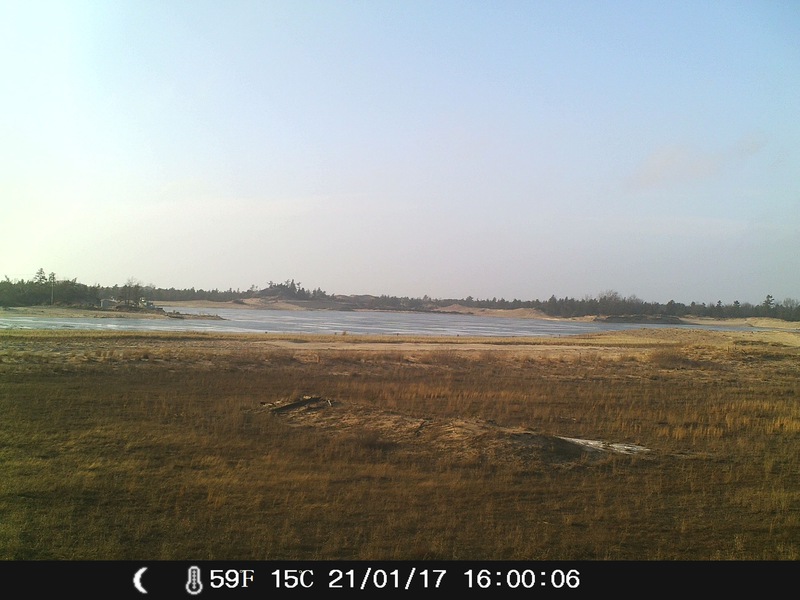
But it appears that this sand quarry has filled with water and photos would not reveal the excavation. So in this case photographic volume calculations might be impossible. Depth finder transects from a canoe might work.
To monitor the sand being removed over time, a camera station could be established where the trucks exit the private property. Motion detection could trigger the camera when a vehicle passed. That way the number and type of truckloads removed from the site could be determined.
Chris
Reply to this comment...
Log in to comment
@cfastie @warren@tayreed@patcoyle
Thanks for this incredibly valuable input as to the potential for measuring extracted volumes and stored piles on the property via 3D image capture. I will link this conversation to Ted Auch from FracTracker Alliance, who may be very interested (or perhaps already knows!) in it's uses. Now... I'd imagine that many of the ignorant (meaning myself) throughout history never thought to check the gas tank when opening up the hood of the stalled/"broken" vehicle...that said, your MUCH simpler motion sensor camera idea of doing a sand-hauling semi count would be another such moment in my prodigious career! ( I think I'll take this easy approach, since I LIVE RIGHT ON THE ROAD close to the Sand mining exit) Humbly, your input has been very much appreciated.
I really like the motion sensor truck counter approach. Do you think the motion sensing abilities of the Crenova trail camera will work for this? Please tell us how it goes!
Is this a question? Click here to post it to the Questions page.
These folks apparently did use timelapse cameras to track truck traffic: https://publiclab.org/notes/mathew/05-20-2014/frac-sand-frisbee-maps-against-mines
Reply to this comment...
Log in to comment
Perhaps see related tutorial on estimating the height of waste piles (the flipside of the problem you are facing here): https://publiclab.org/notes/Holden/03-11-2014/estimating-volume-and-weight-of-petroleum-waste-piles-in-southeast-chicago
https://publiclab.org/wiki/estimating-the-volume-and-weight-of-waste-piles
Reply to this comment...
Log in to comment