NEWS RELEASE FOR IMMEDIATE RELEASE April 30, 2013
Public Lab Aerial Imagery in Google Earth A new large update of over 100 new maps from Public Lab published in Google Earth and Google Maps
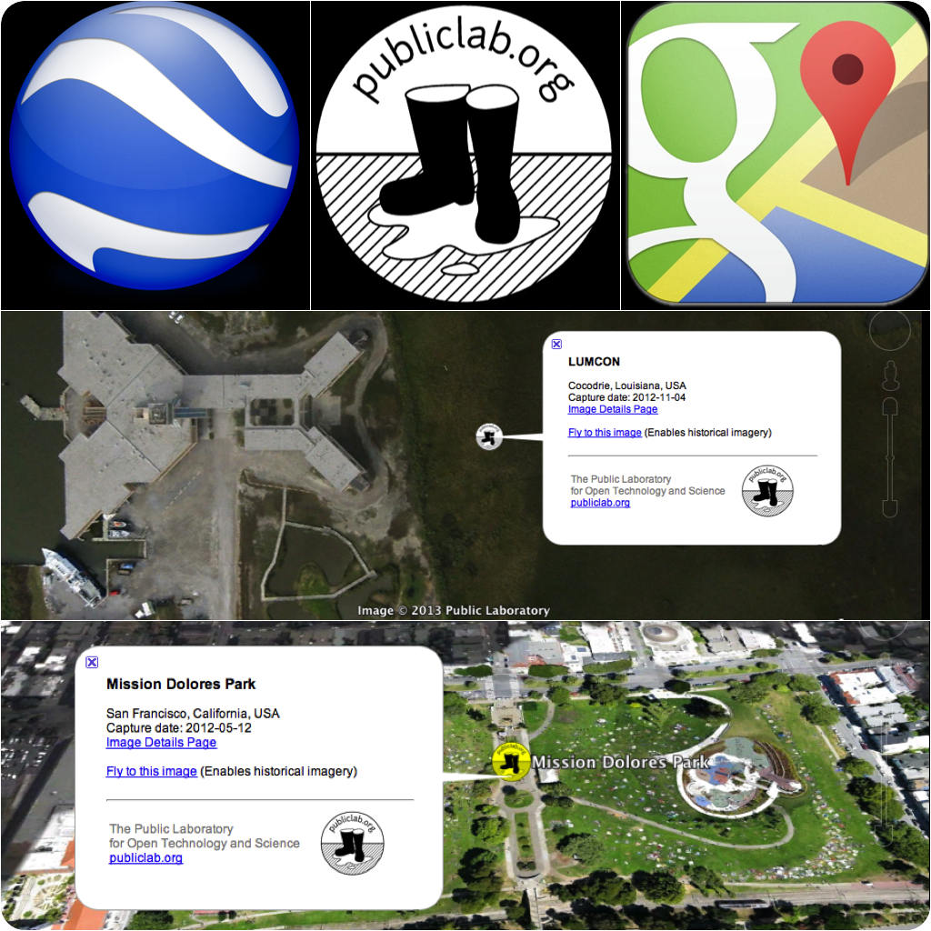
Oakland, CA-- Public Lab is announcing a large new batch of published maps in Google Earth. Since 2012, the Google Earth Outreach team has worked with the Public Lab to periodically publish Public Lab aerial imagery that has the public domain license. Most of the maps produced by the Public Lab community use the public domain license. Having a publication avenue for the community in Google Earth is exciting for the individual mappers and important for the DIY data to get published with the largest and most important map platform (Google).
The collection of maps from the Public Lab map archive can be easily browsed through a Google Earth KML file that will list all of the maps in Google Earth and automatically navigate to each place and time as selected from the list of maps. Google Earth does include many maps across different time periods. The map list will automatically jump to the correct date, but users can also navigate through historical imagery database for different locations through time.
About the Public Laboratory for Open Technology and Science
The Public Laboratory for Open Technology and Science (Public Lab) is a community which develops and applies open-source tools to environmental exploration and investigation. By democratizing inexpensive and accessible Do-It-Yourself techniques, Public Laboratory creates a collaborative network of practitioners who actively re-imagine the human relationship with the environment.
The core Public Lab program is focused on civic science in which we research open source hardware and software tools and methods to generate knowledge and share data about community environmental health. Our goal is to increase the ability of underserved communities to identify, redress, remediate, and create awareness and accountability around environmental concerns. Public Lab achieves this by providing online and offline training, education and support, and by focusing on locally relevant outcomes that emphasize human capacity and understanding. For more information, please visit publiclaboratory.org.
Contacts
Public Laboratory for Open Technology and Science: Stewart Long, Director of Geography and Data, Grassroots Mapping Gulf Coast map processing & publication lead; phone: 760.888.5287; email: stewart@publiclab.org
0 Comments
Login to comment.