
Grassroots mappers in Gowanus have been using the high resolution of low altitude photographs to locate historic streams that can help improve the water quality of a heavily polluted industrial waterway. Local community groups including the Gowanus Canal Conservancy, the Gowanus Dredgers Canoe Club and Proteus Gowanus pooled resources to do some fun mapping and clean water advocacy.
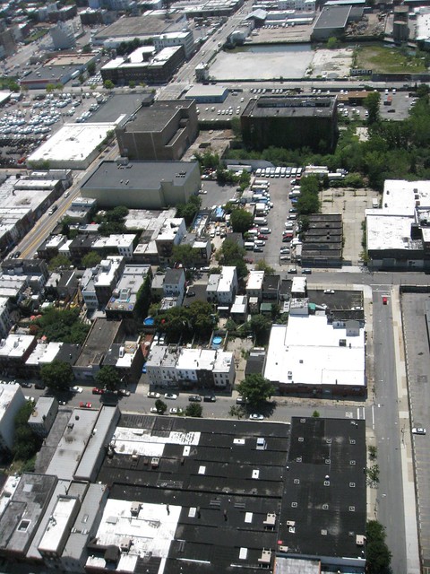
31 July 2011 Birds eye view of the abandoned Brooklyn Rapid Transit Power Station site, adjacent to the First Street Basin Landfill Superfund site. Photo was taken by balloon.
31 July 2011 Balloon Aerial of the First Street Basin, taken using a Canon Powershot SD880IS, using a CHDK picture taking script on the sim card and a home made helium balloon towed by a Gowanus Canal Dredgers canoe crew. Helium gas was provided by Liberty Industrial Gases, a local Gowanus business.
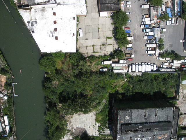
First Street Basin Landfill – Gowanus Canal Superfund Site, Brooklyn, NY View from the future Powerhouse Environmental Arts Foundation.
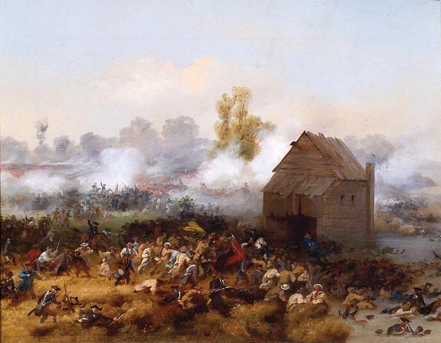
1776 Battle of Denton’s Mill, Alonzo Chappel, painted in 1858
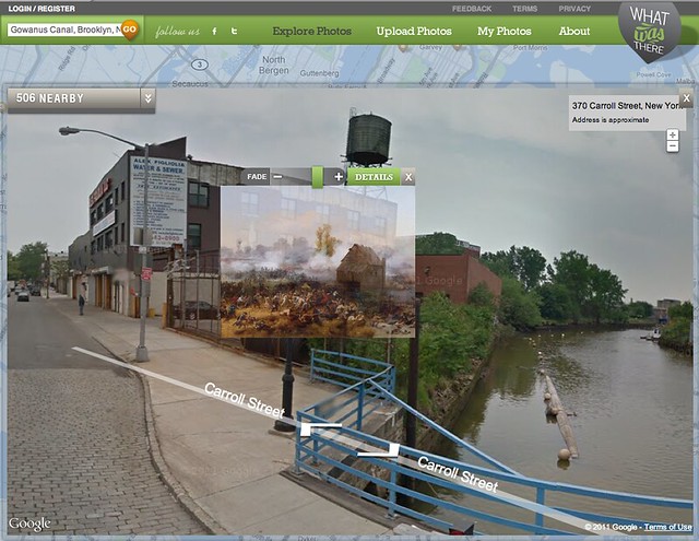 Denton’s Mill overlaid on Google Street view on What Was There (http://www.whatwasthere.com/)
After retreating American troops destroyed Brouwer’s Bridge, stranding fellow soldiers to face the wrath of Hessian and British troops, a desperate battle took place at Denton’s Mill. With the construction of the Gowanus Canal, the tidal mill was destroyed and whatever remnants which survived were buried under what is now the First Street Basin landfill.
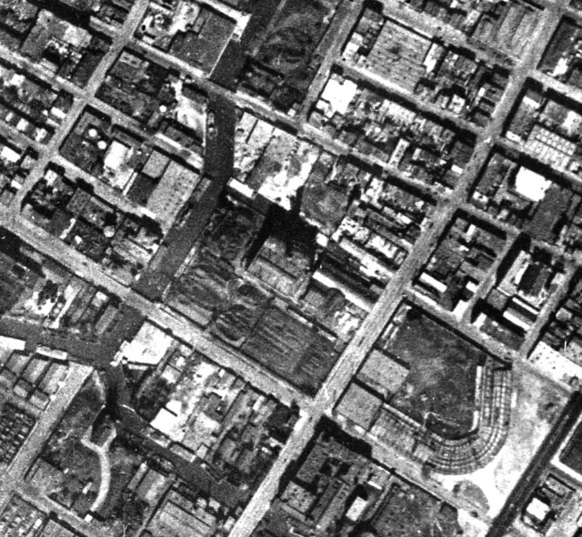
1924 Aerial, Gowanus Canal First Street Basin, Fairchild Aerial Surveys, showing massive amounts of coal used to run the electricity for the Brooklyn Trolley Car System. Note now gone Washington Stadium, home of of the early version of the Brooklyn (Trolley) Dodgers
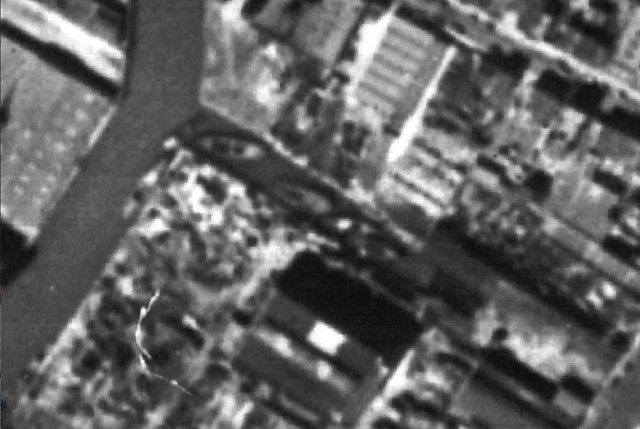
1951 Aerial, Gowanus Canal First Street Basin, showing boats in the basin prior to it's filling with cars and electronic wastes.
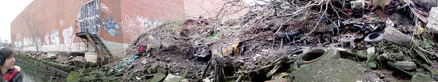
This Revolutionary War battle site is now covered by a dumped layer of Ferroxcube Amperex electronic circuit boards, a company that was bought by the Dutch electronics giant Philips in the 1950’s.
In an acoustic mapping outing with Nerina Penzhorn, the sound of flowing water was discovered coming out of the landfill.
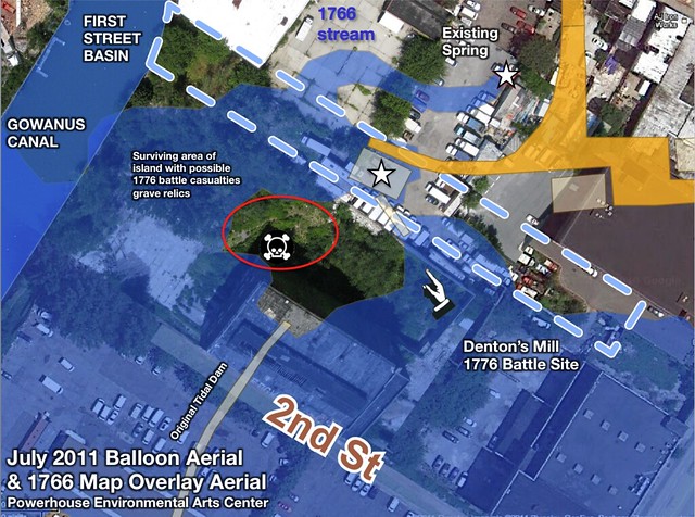
Balloon Photograph of the First Street Basin Landfill Site overlaid with the 1766 Ratzer Survey Map. Blue shows historic streams.

“Grassroots” Mapping gives a clue that the concrete paved parking lot has subsided on top of the historic stream bed, and that plants are growing more thickly through the cracks because the old spring is still running under the concrete.
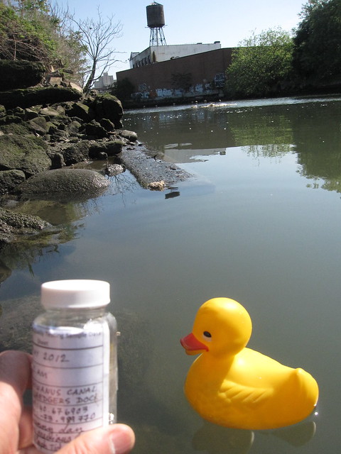
Citizen Science Rubber Ducky on Gowanus
In 2012, the Gowanus Canal Dredgers canoe club teamed up with the River Project (http://www.nycwatertrail.org/water_quality_test.html) to do citizen science monitoring of enterococcus levels in New York City harbor waters. Enterococcus is a bacteria indicative of high levels of sewage in the water. The Gowanus Canal consistently gets the worst water quality scores in the city, for example recording 24,000 cfu per ml (the lab can’t measure any higher) during the Sandy floods. However a strange fact was that the Dredgers had two sample locations a hundred feet apart, marked by rubber duckies.
The location closest to the fresh water inflow area consistently got lower enterococcus scores.
Gowanus Canal Enterococcus Water Quality lab test (photo by River Project, June 2012).
This led the idea to include the restoration of the First Street Basin as one of the many ways New York City’s Department of Environmental Protection could work with the Superfund Community Advisory Group to help improve Canal water quality. The City is currently helping divert storm waters from overburdened sewers through the construction of the 20 million dollar Third Avenue High Level Storm Sewer.
The City’s current proposal is to connect the collected stormwaters via a concrete pipe by digging up what was historically the highest driest ridge that crossed the Gowanus marshes, and that underlies Carroll Street.
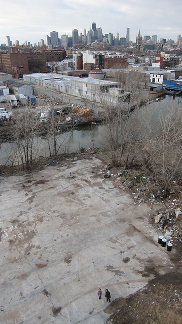
One block south of this proposed connection to the Canal are the abandoned City controlled First Street and 2nd Street rights of way. These are currently contaminated landfill on top of the old Denton’s Spring and Pond that fed into the original Gowanus Creek. These would be perfect sites for green infrastructure street pollution runoff prototypes and could celebrate the daylighting of a historic stream and landmark of the American Revolution.
13 October 2012 - Fresh Water flowing into the polluted Gowanus Canal from Denton’s Spring. Often such “streams” are just broken water pipes. This one seems to flow year round, and attracts schools of small fish and herons.
For more information on Lost Rivers see: vimeo.com/50839044
1 Comments
This is a really remarkable project. I love the aerial views -- especially the one showing the skyscrapers on the horizon...
Reply to this comment...
Log in to comment
Login to comment.