https://www.flickr.com/photos/eustatic/7165625584/in/set-72157629653527524/
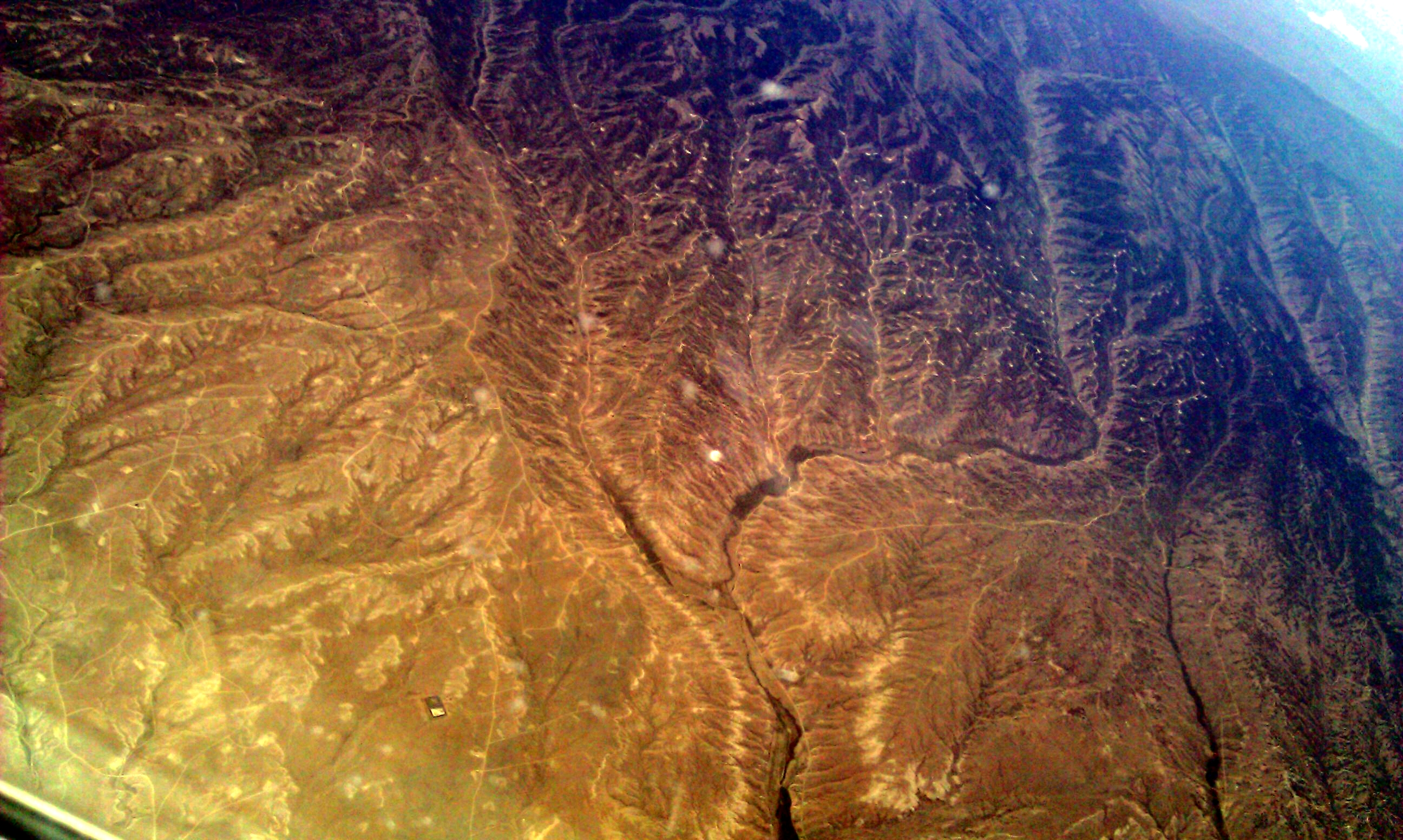
my phone GPS was not working at 20k feet, so i don't know where these photos were taken--somewhere between PDX to Houston, closer to PDX. but these are drill pads. Just like in Louisiana.
There's photos of Salt Lake(?) taken just before these.
Wyoming? 41.427283,-110.842438
Was there ever a One-Pager written?
Could the Passenger Pigeon Site include Baton Rouge (nee Exxon) and Norco (nee Shell Motiva) as potential sites to photograph from starboard-side windows approaching BTR and MSY, respectively?
4 Comments
Definitely. Do you know people that fly into BR ever? When I was flying from the Midwest back, we also came in over the Mississippi (who knows why, maybe just circling) probably around upper Plaquemines/St. B area I'm thinking, that would be another spot to see if we could get schedules for.
Is this a question? Click here to post it to the Questions page.
Reply to this comment...
Log in to comment
Sweet. Amazing.
I wonder if you could browse Google Maps and find a lat/lon for some of these... i'd love to help stitch them in MapKnitter. The body of water looks like it could be a good landmark...
Woohoo! I found it -- the very gnarled lake is Starvation Reservoir, near Duchesne, Utah.
Reply to this comment...
Log in to comment
I bet the NPS there would appreciate the images- esp. showing that the drill sites are pretty much all above the reservoir. Sick.
Reply to this comment...
Log in to comment
MapKnitter map (started with just one image, feel free to add):
https://mapknitter.org/map/view/starvation-lake
Is this a question? Click here to post it to the Questions page.
Reply to this comment...
Log in to comment
Login to comment.