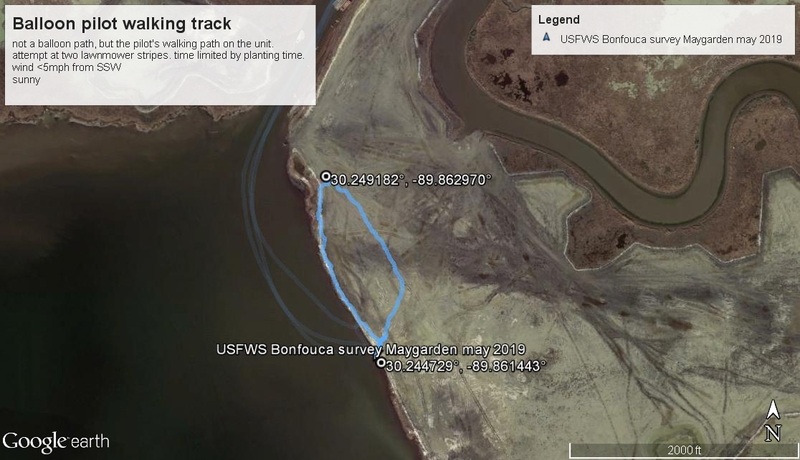
Louisiana Master Naturalists, Teen Outdoor Education and Service (TOES), and Pontchartrain Institute for Environmental Science were invted by USFWS to plant the southern cel of the PO-104 Bayou Bonfouca Marsh creation, and to document the vegetation that has volunteered at the site since Spring 2018.
Oct 2016 aerial survey photos here

TOES participants reeling in the balloon, at the Spartina planting site. visible in the photo are three-corner grass, sedges, Baccharis, and other volunteer freshwater plants growing among the plantings.
Volunteers planted roughly 300-500 Spartina patens plugs at the site, which is expected to be productive wildlife habitat, as well as local storm surge protection for coastal St Tammany Parish, for the 20 yr life of the project. Since salinities are expected to shift over the 20-year life of the project, it is useful to plant the site with more saltwater-tolerant species than are colonizing the site naturally.
We emptied an 80cu ft tank of helium into a cloudburster balloon from the kit, and flew it on a 2500' ft line up into the <5mph wind, which was blowing from the SSW. We loaded a rubber-band triggered, A810 canon into a juice bottle rig and flew roughly 300 ft, then 1000 ft on the return trip. We did one "lawnmowerish" loop with the balloon, taking roughly 45 minutes of photos, and taking 10 minutes to retract the 1000ft of line into a re-purposed extension cord reel that I have used since 2014.
Louisiana Master Naturalists also photographed plant species, along with White Pelicans. Mullet seen swimming out of the northern side of the site.
See the cel phone track, taken from a pilot on the ground.

CartoCollective**
**
Images are listed at the Cartocollective spreadsheet here, shared via google drive
Objectives
map (photograph and identify to delineate) the Spartina patens plugs planted on the site
create a general map of the site
compare the range of planted brackish water species with volunteer freshwater species.
Results
1620 photos were taken in 53 minutes, 88 selected and shared via CartoCollective.
survey Mapknitter here (9+cm resolution)
planting Mapknitter here
Initial photos are posted here, although i'm having the usual markdown troubles, and can't post them to the note.
Discussion (pending)

1 Comments
Is this a question? Click here to post it to the Questions page.
Reply to this comment...
Log in to comment
Login to comment.