Southwest Flight 2264 7am TPA to 7:40a MSY
Nikon DSLR d3200
visibility 10 mi at KNEW
Scott Eustis, camera and stitching
Jesse Shamon for completing the stitching
and AnnieLaurie Erickson, Tulane ARST 3020
https://mapknitter.org/embed/ppigeon-lake-lery-restoration-project-2016
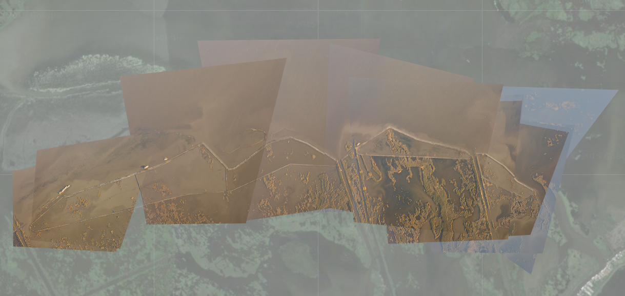
I was flying back from Tampa to New Orleans, and so snapped some photos out of the plane window at the Lake Lery operation, on the morning of February 5th, 2016.
Here's the project specs: http://lacoast.gov/reports/gpfs/BS-16.pdf
I thought it was awesome that i could get this from a commercial flight. I think you'd have to fly a Cessna at about 4000 feet to get something simliar--that's the main problem I've had with documenting the West Bay restoration from the airplane.
Update
https://www.fws.gov/gisdownloads/R4/Louisiana%20ESO/Clark/Task%20Force/CWPPRA%20Construction%20Update%20South%20Lake%20Lery%20(BS-16)%20rev.%2010-12-2016.pdf%20rev.%2010-12-2016.pdf)
On the Passenger Pigeon Map of Lake Lery:
I flew from Tampa, FL to New Orleans. I sat on the right side of the plane, in a window seat behind the wing. This seat let me photograph obliques of a new restoration project, the Lake Lery Shoreline Restoration. Lake Lery's shoreline has disintegrated to oil pipelines and hurricane Katrina, and our federal agencies--USFWS in particular--are spending money to replace the shoreline marshes. These marshes are public, recreational fishing areas, as well as nursery grounds for many estuarine species.
1 Comments
I love this map. It's so great.
Reply to this comment...
Log in to comment
Login to comment.