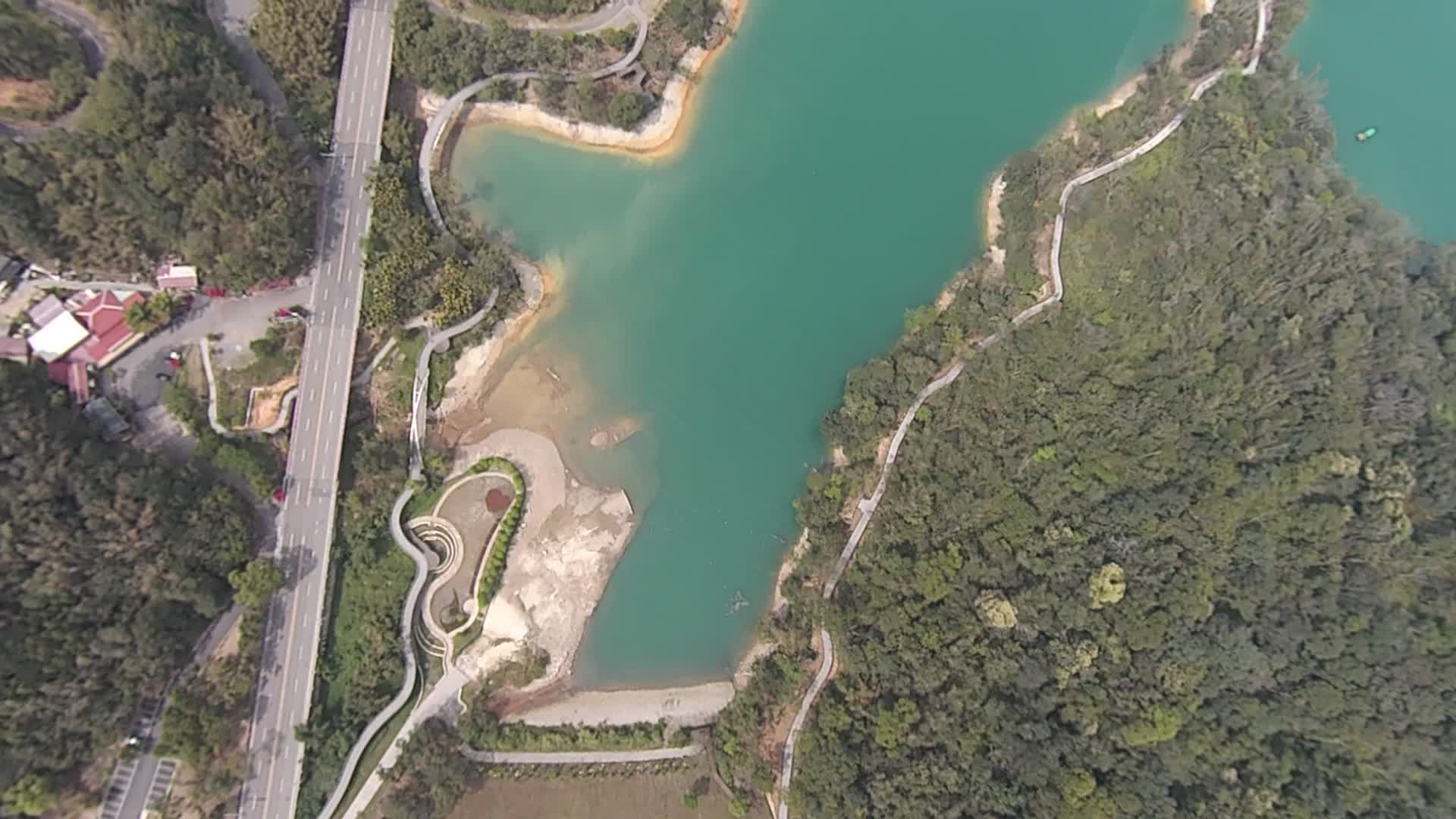
The main purpose is to observe the Sun Moon Lake Reservoir sedimentation situation, these photos were taken by UAV in April 8,2015, there are two points to note following:
- If there are no photos, that mean the shore without sediment deposition;
- Some pictures are not vertical shooting, resulting in elongated object, and the actual size and shape would be some differences;
- with the second point, the white is shore; the khaki color is silt.
4 Comments
Ooh, nice! What are you looking to document here?
Is this a question? Click here to post it to the Questions page.
Reply to this comment...
Log in to comment
Hi Peter, the coverage you got around the shoreline of the lake is really impressive! Can you share any other information about why you are worreid about sedimentation? if there heavy development occurring in the lake's watershed? Are you working with anyone else in Taiwan? CCing @muyueh
Is this a question? Click here to post it to the Questions page.
Reply to this comment...
Log in to comment
Hi Liz, thanks for your appreciation. Because there is water shortage in Taiwan in spring, we want to know how severe the sedimentation really is, and practice the map knitting skill. We represent NUKIM on this project, and I am student of professor Han Wei, so actually I don't know whether the development problem occurred or not, haha!
Reply to this comment...
Log in to comment
Hi Peter, Fantastic! Thank you. Can you send me a link to NUKIM? What department is professor Han Wei in? I'd like to be in touch.
Is this a question? Click here to post it to the Questions page.
Reply to this comment...
Log in to comment
Login to comment.