Tracking recreated wetlands in Jamaica Bay: Gena Wirth and the Dredge Collaborative
Published in 2013 Grassroots Mapping Forum#4.
Order a copy or subscribe online. Only $15/year!
written by Gena Wirth
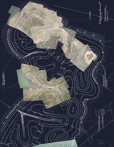
The cover image shows a flat expanse of newly constructed ground in Jamaica Bay known as Yellow Bar Hassock. Our balloon aerial images were rectified against Army Corps of Engineers (ACE) contract drawings.
Rob Holmes of the Dredge Research Collaborative and I are conducting aerial imaging in this area. We aim to document the progress of two different approaches to wetland restoration. The first approach is the Army Corps of Engineers’ (ACE) professional restoration of eroding salt marsh habitat with recycled dredge material, shown here on Yellow Bar Hassock. The second approach is an all-volunteer replanting effort organized by the American Littoral Society on adjacent island Black Wall.
Yellow Bar Hassock is in constant transformation. For decades the hummock has been shrinking and losing ground due to intensifying urban impacts in the watershed. This pattern recently reversed course under the direction of the ACE, who use the island as a site to dispose of dredge material and as a test case for expanding ecosystems in decline.
Like much of Jamaica Bay the resulting landscape is neither fully industrial or fully natural, though it retains aesthetic and performative qualities of both.
We have been focused on the complex marsh matrix of sediment, Spartina, and ribbed mussel, which in a functional ecosystem colonize the base of the cordgrass and stabilize the marshland. Beyond the dotted fringe of cordgrass clumps our photos document the expansive island interior, touched by the ACE in a more economical fashion with a grid of fences marking Spartina plug planting zones.