Aerial Balloon Mapping
Objective
Use one of the public labs DIY helium balloons to do mapping of a local invasive aquatic plant Water Chestnut and to help map in downtown Amherst to assist in city planning.
Mission
This project has 2 parts or 'missions' to it the first part being an aerial photo mapping of a local invasive species (Water chestnut) at a site (Westfield). The cameras used have been adjusted for one to be RGB and the other infra red. They've also been set to shoot photos simultaneously every 7 seconds.The goal is to upload these images into some sort of photoediting software such as photo shop in order to highlight the water chestnut canopy. From the highlighted photos we want to upload into ArcGIS using tools such as georefrence (in order for the map to be correctly located) and then use almost a suitability analysis to map out the invasive.
The second portion to this project is aerial mapping in the town of Amherst. We hope to do this in an area that is building a large apartment building but are looking for an area close by that could possibly be used as a parking lot. The goal is to use the aerial balloon mapping images to show potential spots within a certain distance of site that could be turned into a parking lot. The steps for this are similar to those of the invasive plants once images are taken and inputted into ArcMap
How?
Using a helium filled 5 foot balloon attached to a 3D printed camera rig that has two cameras (RGB and infrared-see below).

Cameras used for aerial photographs


Camera rigs with cameras on

Balloon pre set up
First attempt at balloon and kite flying
On Wednesday October 15th we had our first 'trial' run with our helium balloon and the DIY mapping! The weather was not exactly ideal but we were all still excited to finally get the balloon in the air [after much complications with actually getting helium to fill it]. A lot of students from the class came out to show support, help and just see this actual contraption go up! We started it out by first filling up the balloon with helium tank [since this was our first time we were unsure of how much helium it would need to lift the camera rig, we ended up having to go back and fill it a bit more after the initial fill up but hey that is all part of the learning process] after we got correct helium to lift the balloon it was time to attach the 3D printed camera rig with cameras [set to take photos every 7 seconds with 4 second intervals] to the balloon. We were a little unsure of how to do this at first and tried to follow what directions we had and ended up attaching in two spots which seemed to work well [most of this can all be seen in the many pictures I've uploaded documenting the steps below]. After this we were set for the first trial and lift off of the balloon! And it worked! We we're just outside of Holdsworth on the UMass Campus but we got lift off [considering the weather] for a bit before we decided that maybe it is safer not to fly now and wait until the wind is well a little less windy...But since there was wind and we were already out there we decided to try out the kite. We went down to the fields near the Mullins center [they offered a little more space...and less of an obstacle of items to run into] we used the 9ft kite [the larger of the two] and attached the camera rig in a similar way as we did to balloon and took off. We found that as it was windy it was still a challenge to get the kite up there and did require a lot of space and heavier winds for the weight of the rig. It also may not be as an exact picture for the type of aerial footage we are looking for. But lots of fun to fly and see it all in action none the less.

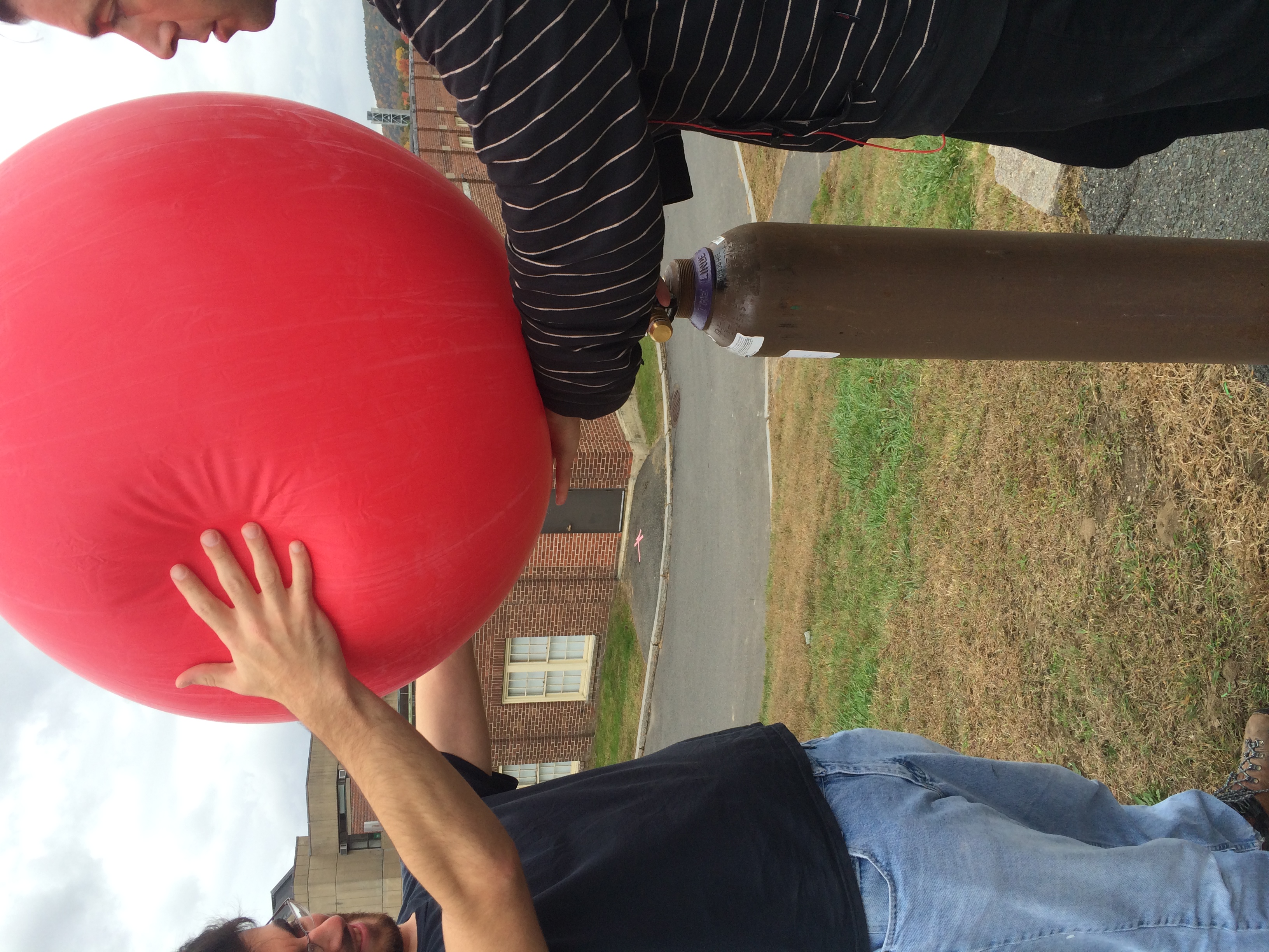
Getting helium tank set up to fill balloon


Starting to fill the balloon

Our makeshift way to hold down balloon using railing and bungee cord

Attachment of camera rig string to the balloons tether


And once all set
Also here are a few photos from the kite with camera rig first flying attempts


Local Invasive Aerial Mapping in Westfield
Professor Charlie Schweik and a fellow student of mine working on this project, Tony Volpini went out to Westfield (Brick Yard Ponds) Monday morning (October 20th) to try out the balloon mapping of invasive aquatic plants in the area. They were looking at water chestnut a local invasive here in Massachusetts.The reason why is actually quite interesting, the area used to be a popular fishing pond with the locals but since the invasive water chestnut has taken over it has become hard to fish and even have your boat out in the water during its peak season.The town had asked Karen Leigh who is a conservationist there to help solve this problem. When she learned about the project we were working on we decided to work together using our aerial balloon mapping and her study area to. Professor Schweik and Tony were using the RGB and infra red cameras to try and definitely see plant canopy in the water. We're hoping to use the images taken on Monday and hopefully photo shop out the areas with water chestnut or highlight them and then take these images and put into ArcMap. Here is a link to an article written about Charlie and Tony's time at Westfield, MA [http://wwlp.com/2014/10/21/technology-used-to-combat-invasive-plant/]
The study area of water chestnut in Westfield

these images were give to us by Conservation Coordinator Karen Leigh

Here are the infrared pictures taken from aerial balloon


These images were from Professor Charlie Schweik


These images were taken by Conservation Coordinator Karen Leigh
Aerial Balloon Mapping in Westfield, MA (Second Time)
Professor Charlie Schweik, Tony Volpini, Hannah French and I (Alexandra Ferland) went back out to Brick Yard Ponds in Westfield on Saturday (the 25th) morning. We were hoping to get RGB pictures since we weren't able to the previous time due to user error and/or camera malfunction (still a little unsure why it didn't work). So we hooked up the camera to the camera rig still using just one camera (see image below technique we used to tie the camera string to keep rig balanced). Due to the amount of helium we have and size of balloon we've been just using one instead of the two cameras on the rig. We had brought a canoe on this trip in order to get out into the middle of the ponds to get a aerial shot of all the ponds to get a better view on the water chestnut. Unfortunately the weather on Saturday was a bit windier than we had hoped for and while we got out in to the canoe with the balloon and camera rig the wind was stronger than we hoped and the balloon dipped are camera into the pond a few times. But the trip was not all lost...it ended up actually still being very productive. There was a small field on the adjacent side of the pond that where we launched the balloon from with the infrared camera getting it up to 300 ft and got some good shots of the area. We also went out into the canoe and were able to get the exact latitude and longitude of locations where we saw water chestnut. Moving forward we are hoping that the memory card on the RGB camera captured something and hopefully we are able to fix camera. A little interesting fact about this area and unique challenge (I don't think I mentioned previously) is that the location is close to airport. This means every time before we can launch the balloon we have to call airport tower to tell them we are doing so AND keep it under 300 feet at all times ( I mean this airport does have F-16). So to anyone who may be doing aerial balloon mapping in your hometown or wherever make sure if you are by an airport to reach out and make contact with them.
Georeferencing in ArcMap
Karen Leigh had given us a GIS map of the study area which looked like this:

Professor Schweik and I used this jpeg image in conjuncture with Google maps to preference the image. We used 'add control points' to make six separate points on the image using buildings or roads (something decipherable on both maps) to match them up. After marking six points on the image we opened the 'view link table' in order to input to latitude and longitude (in decimal degrees) that corresponds with each of the points (we used GoogleMaps to get the latitude and longitude). After this we saved and exported map in order to reopen in ArcMap and set it with a spatial reference to WGS 84 (the same that GoogleMaps uses) and to check that our points were accurate I downloaded a road layer from MASSGIS and overlay it onto our image to make sure all the roads lined up with ones on image and they did (YAY). From this we will need to move forward doing the georefrencing but with an image to image georeference using the near infra red and hopefully some RGB).
Images from second trip:


Images of the study area itself


Image of water chestnut in Brick Yard Ponds

Camera rig with camera wrist strap tied around rubber tube to help keep rig balanced while flying

Getting the balloon filled with more helium for flight

Group shot (Hannah, Tony, Ally)

Out on the canoe in Brick Yard Pond


Images from the balloon flying the near infra red camera
Flight in downtown Amherst, MA
We recently flew downtown Amherst in an area where there is new construction near Bertuccis restaurant. Professor Charlie Schweik, Michal Lumsden and I flew the balloon in hopes to get an aerial shot of the parcel of land that the new construction is being built on. Since there are no recent photos of the area since 2009 and a lot of construction has occurred since then. Here are a few images from that flights:


Flight at local middle school in Amherst, MA
Professor Schweik and I also did a demonstration at a local middle school here in Amherst, MA for the students who are part of the 'Maker Monday'. We launched our balloon in the back field near the tennis courts and let the kids form a circle under the balloon while it was flying and played a game of whoever was the last one in the frame won. We educated them on the uses for this type of mapping and the implications it could have. They were all very into it and loved the pictures that came out.