What I want to do
Continue to update maps with construction site activities across the street from Mocho Park, Livermore CA. As previously noted, recording construction or other activities over time is one use of these tools. Initial mapping of this site was conducted in September 2013 and described in note and note.
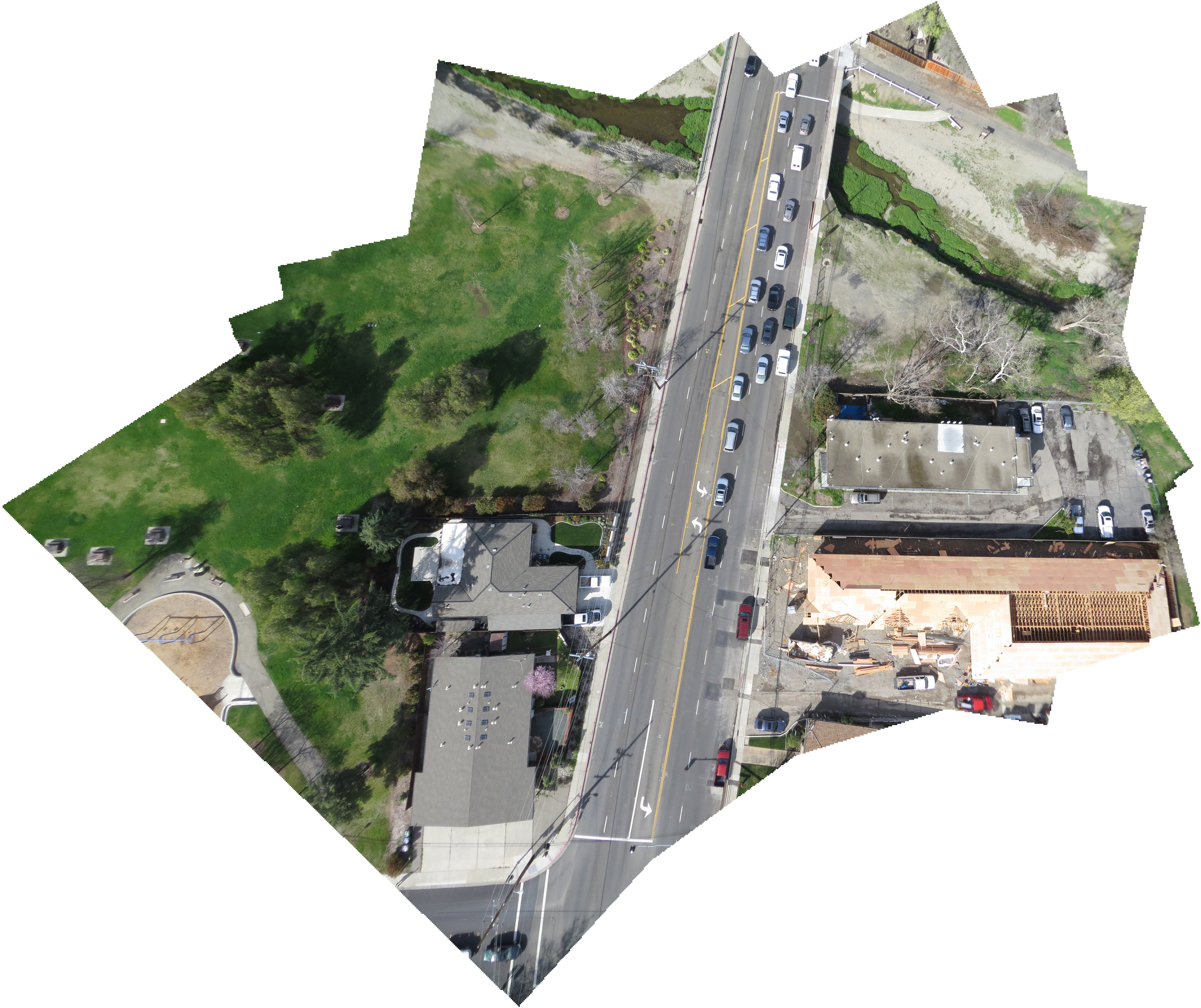
The main image and map below show the construction progress as of late-February 2014. Roof sheathing is in progress.
The following image shows the construction progress as of mid-January 2014.

The following image of the site shows initial site preparation and excavation for footings.

The following image of the site shows initial site preparation and excavation for footings.
My attempt and results
Flew quick KAP session to capture construction site activities and adjacent areas. Flew Delta 9' Levitation with juice-bottle rig, two-point connection to kite line with loop through S-biners with Brooxes Hangups (as alternative to Picavet), SX260HS, running CHDK intervalometer script. Wind was out of the southwest, so not able to get camera as far over the site as would have liked. Mocho Park where I flew from is bounded on the south and east by power and telephone lines.
Questions and next steps
I want to continue to update maps of this site as construction progress continues.
Why I'm interested
The capability to document changes in our built environment is a key benefit of the Public Lab tools.
0 Comments
Login to comment.