How to Map
Workshop 3: How to Map
There are three main types of DIY mapping techniques identified by the Public Lab Community: 1) Balloon Mapping 2) Kite Mapping 3) Pole Mapping ** some people have also done a hybrid mapping technique that uses both balloons and kites
You should choose the mapping technique that best suits your needs and environment. Here are a few pointers in deciding which will work best for you:
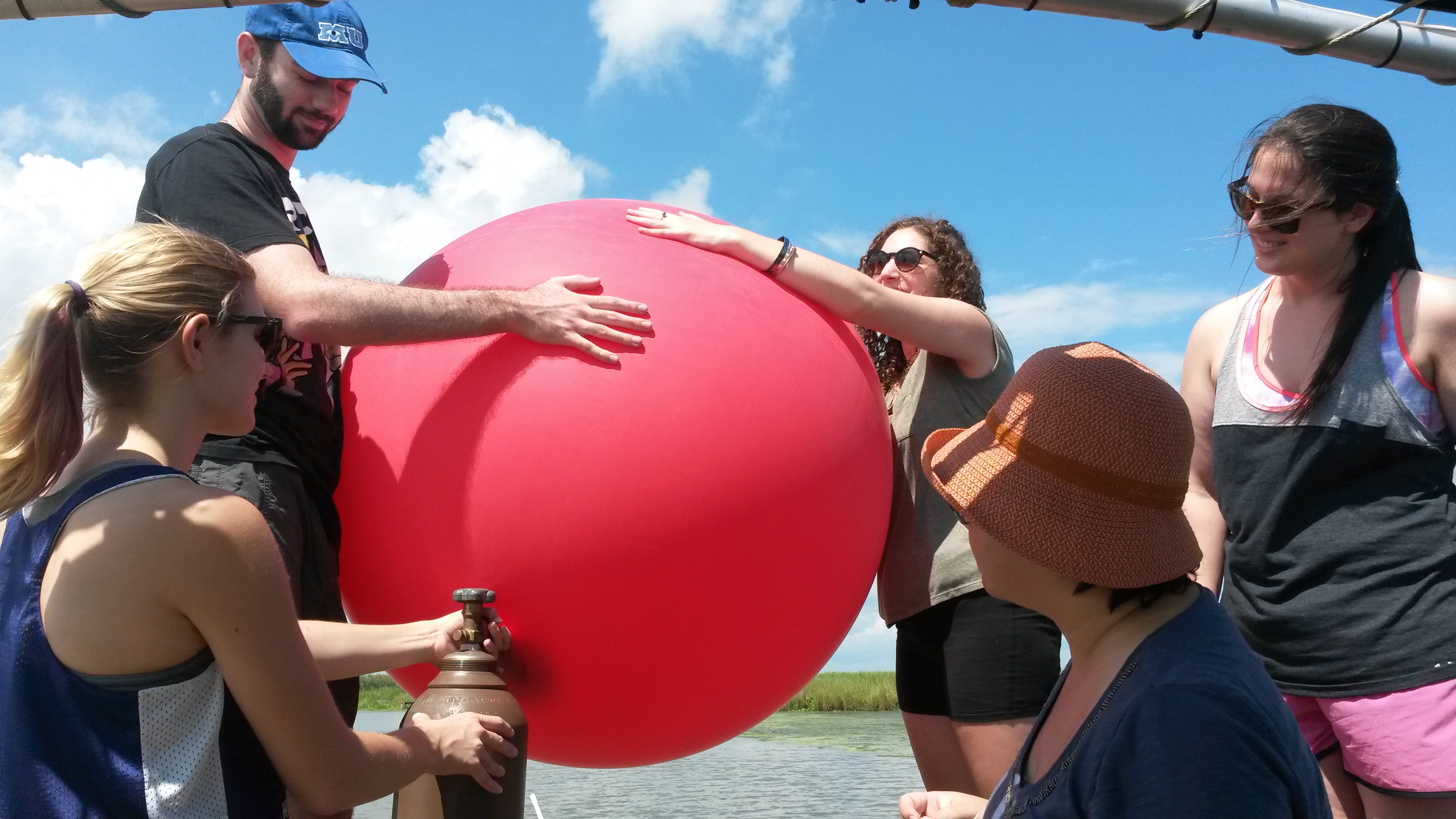
Balloon mapping
Balloon Mapping is best done when: 1) There are no competing overhead obstacles (trees, power lines, buildings etc. 2) The winds are fairly calm (no more than 10mph) and 3) You are looking to capture single images that are larger than one acre in size.
Limitations of Balloon Mapping 1) Because balloon mapping requires helium, which can be expensive (about $60 worth of helium for each flight, as of 2015), if you’re on a budget you might consider kite or pole mapping. 2) Balloons will need to be replaced every 4 or so flights. 3) Balloons should not be used on windy days, they become uncontrollable. 4) Unless you are pulling your balloon (for example in a boat), your balloon will be prone to moving with the wind currents, if the wind is not blowing in a desirable location for your mapping site, you will need to move or change your strategy. 5) With balloon mapping, it is better to have at least 3 people.
Kite mapping
Kite Mapping is best done when: 1) There are no competing overhead obstacles (trees, power lines, buildings etc.), 2) The winds are 10mph or above, and 3) you are looking to capture single images that are larger than one acre in size.
Limitations of Kite Mapping 1) Can take some time, we suggest you always run a practice flight without a camera first, here are some great tips for kite mapping 2) Best done with at least 2 people.
Pole Mapping
Pole Mapping is best done when: 1) You have competing overhead objects, 2) You don’t need images that show larger than a single acre in size, and 3) You are mapping on your own. (you need a lightweight pole for this, such as the one the Public Lab store sells
Limitations of Pole Mapping: 1) Pole mapping will only capture small areas at a time. This can make the images hard to stitch.
Once you have decided which type of mapping to do, you can plan your mapping trip!
Materials you will need to assemble:
Unless you will be using a pre assembled rig for your camera such as a KAP rig or a clamp for pole mapping, you will need to build a rig for your camera. Here is a great video that shows one example of how to do this.
A short video by Mathew Lippincott on setting up your camera.
For Kite and Balloon Mapping:: Materials for kite mapping are very similar to balloon mapping, except that they require a kite instead! The kite mapping wiki can help you decide which kite will work best for you. This link also includes a great list of materials you’ll need otherwise for your balloon or kite mapping trip
For Pole mapping:: For pole mapping you will need your pole (again here are some models you can look into, or the pole sold in the Public Lab store.) To attach your camera to the pole you will need to either attach it directly using hardware such as those found in this research note or by employing a rig and attaching it to the top of your pole. Before you go to your site, be sure to check that the pole will support the weight of the camera. You should also make sure that it is something that is easy for you to manipulate around, (so you capture the site you’re looking to catch and don’t hit any obstacles that might be in your way). Note that your pole may seem light in calm conditions, but windy weather can add pounds of weight on your pole, stressing yourself and your equipment. If your pole is sturdy, but harder to handle, one thing you can try to do is attach tethers to it and work with other people to map your site holding the tethers.
Best times to go:
- Generally the best time to do mapping is in the morning.
- Clear weather days are always good as well.
- You will want to think about what you’re aiming to capture, for example, if you’re hoping to catch near infrared images of the marsh vegetation, it might be best to avoid the winter months.
Preparing the camera to launch
8gig SD cards are generally large enough to support an hour of flight/picture time. Make sure that your SD card is clear of all previous photos. Once your rig is ready to go, point your camera to a spot in the distance and turn it on. This ensures that the focus is set to take photos at a distance. Make sure that you hear that your camera is taking continuous photos (you should hear the clicks).
Best practices for balloon mapping:
Balloon mapping generally takes at least three people, one to fill the balloon, and two to hold it. - The balloon mapping wiki has great tips and steps on how to get started. - Materials Needed
Best practices for kite mapping:
Kites can be made to fly in different directions based on the tails you put on them, longer, heavier or multiple tales on one side will make your kite slant in the direction of the tails. - Here are some Kite Mapping tips:** - Kite mapping tips for urban areas
Best practices for pole mapping:
Make sure that your camera is angled over your desired target, for example, if the camera is right above you, you will end up with a lot of photos of yourself. Here is a guide for pole mapping However this wiki can help you decide which type of pole you’d like to build (or buy).
Now, you’re ready to go map!