Harvey Images
This draft page is attempting to create a workflow for people to identify reportable issues captured in aerial photography of Harvey-affected areas, specifically industrial sites.
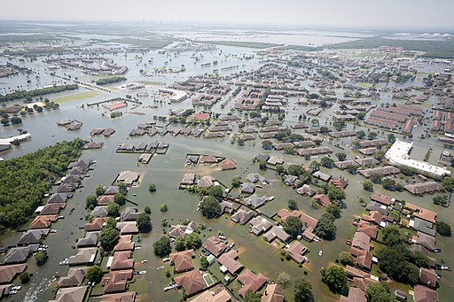
Photo: By SC National Guard (170831-Z-AH923-081) [Public domain], via Wikimedia Commons
Steps to report
Here we're organizing the required steps. We can make each into an activity later, and begin doing more outreach.
Compile sites
- Gather/compile lists of at-risk sites in TX (oil refineries, sewage, nuclear etc.)
Main source: Surging Seas: Risk Finder -EPA tool allows coastline reports by state and specific risk (ex. oil refineries)
Gulf Restoration Network Map of Oil
Sierra Club Map of Toxic Sites Harvey
Texas Commission on Environmental Quality - Data Tool
Add other sources here (you'll need to be logged in)
[prompt:text:Add site here]
Compile image sources
- Gather satellite or aerial images--before and after may be needed
Image sources:
TX National Resources Information Center -"before" images
The Texas General Land Office -"before" images
USGS Earth Explorer Tool-possibly "both" images
Compare to aerial images
Check through images for listed locations for flooding-in some cases you can see sheen or waste
* Images may have meta data with GPS aligned with plane location, so it won't be perfect--might have to search a bit
* Flooded or suspicious locations should be compiled in a spreadsheet for report
* Do screen capture of the footage to attach to report
* Check to see who owns imagery, which may impact who needs to receive report
videoexplaining, maybe, what could be done (bad audio?) https://youtu.be/O2bV1a1gNfA
master sheet of links https://docs.google.com/spreadsheets/d/12ZMti2lH4sST6Apzp_DeCQld4z4ioTmm7LdFiF8fK4A/edit#gid=1
Facilities lists to scan through
Source information for facilities
https://drive.google.com/file/d/0B7ipKYaoi-eYMFMwZU1qZm94d1U/view?usp=sharing
map of these data
https://gulfwetlandsmap.carto.com/viz/c827e7ac-e17a-4a83-a3b6-4e075f4172c6/embed_map
Imagery sources to scan through
NOAA imagery to scan: