Barataria Bay Mapping Project
This page will be used to organize mapping trips, data sets and all other information related to this project. A description of the project can be found here.
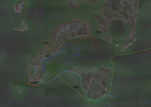
- Barataria Bay on Google Maps: http://goo.gl/maps/lgYBN
- Planning spreadsheet for processing barataria bay maps
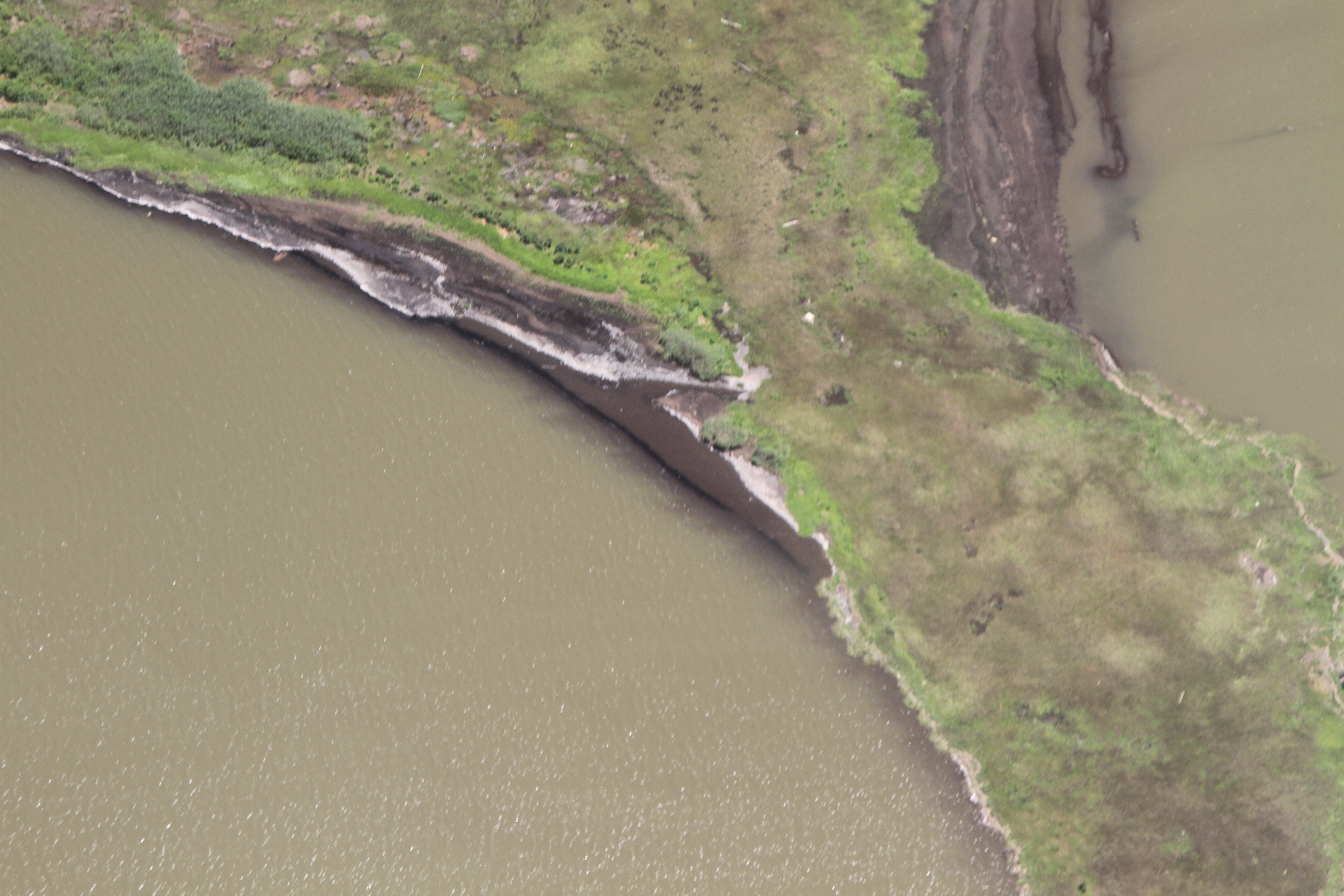
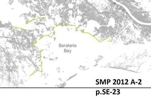
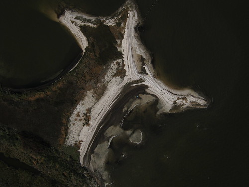
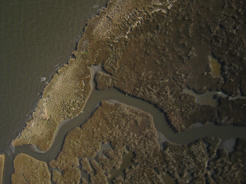
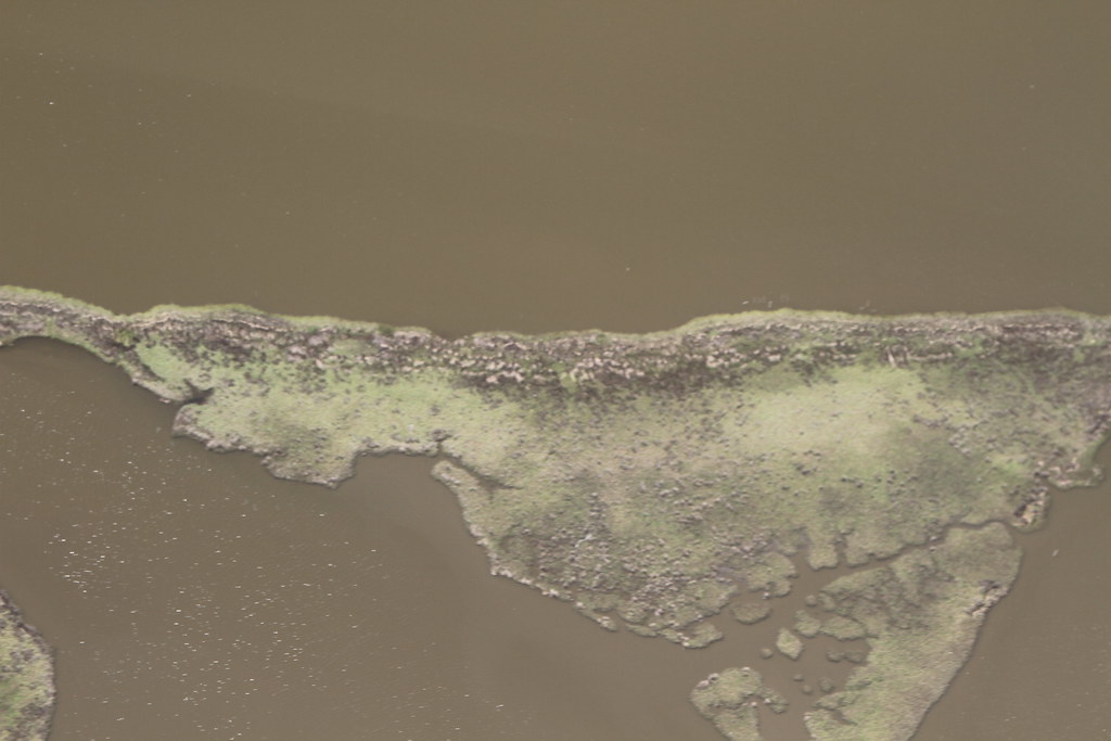
Barataria Bay is growing rapidly, as the northern rim marshes lose land rapidly from accelerating erosional forces. BP's oiling was very heavy in these areas, which were and continue to be difficult to clean without destroying outright. BP's oiling is accelerating the erosional process in this area. This photographic effort and mapping allows us to show that in great detail to a mass audience, and hold BP accountable for its damages, despite its massive Public Relations campaign and close ties to the US government.
Eventually, the State of Louisiana plans to restore these "Rim" marshes (SMP 2012 A-2 page SE-23, project 002.MC.07, $216 million). Therefore, it is vitally important to record how the oil is affecting the erosion of these marshes, so that that project has the highest change of success.
1 | 2 | 3 | 4 | flight | 5 | 6 | 7 | 8
Ioby campaign link:
Contact information to get involved:
Scott Eustis: eustatic@gmail.com, scott.eustis@organizers.publiclab.org
Shannon Dosemagen: shannon@publiclab.org
Becki Chall: becki@publiclab.org
Stevie
Past post on image stitching in wetlands: http://publiclab.org/notes/gonzoearth/1-4-2012/georectifying-wetlands
First Trip: February 9th
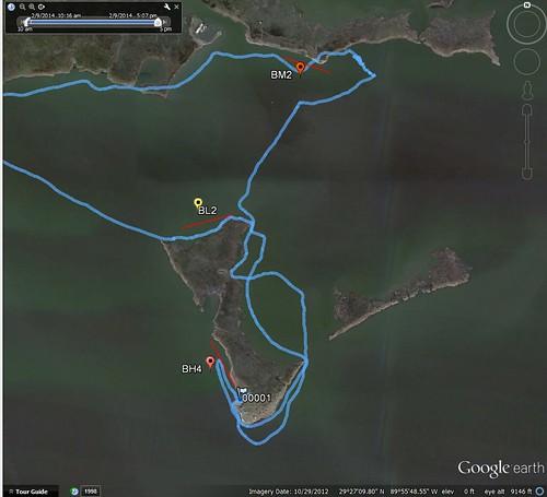
mapknitter placeholders: Feb 9th 1: BL2 Feb 9th 2: [to be done] Feb 9th 3: BM2 [to be done]
Cartography Collective: Second set is not in the Cartography Collective document.
BL1 first set, dark: https://drive.google.com/folderview?id=0B32DNGN8pX_XdlY5b0oxVHpMeE0&usp=sharing
BH4 second set, lack of focus https://drive.google.com/folderview?id=0B32DNGN8pX_XWDFWc3l5alFlNlE&usp=sharing
BM2 third set: https://drive.google.com/folderview?id=0B32DNGN8pX_Xd1I4cTdnWld5MEk&usp=sharing
flickr: https://www.flickr.com/photos/eustatic/sets/72157640862266313/
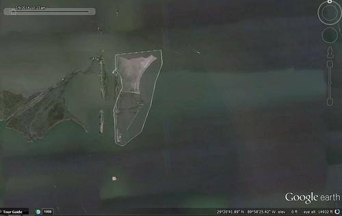
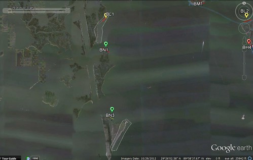
Second Trip: February 16th
Research Note:
first site: Barataria channel --SPE
second and third sites, below
mapknitter placeholders:
Feb 16th 1: BCS SPE [to be done]
Feb 16th 2: BN3 east [to be done]
Feb 16th 3: BL1 [to be done]
Cartography Collective:
Second set is not in the Cartography Collective document.
BCS SPE first set, large: https://drive.google.com/folderview?id=0B32DNGN8pX_XT1EtWWhzZndxNmc&usp=sharing
BN3 east https://drive.google.com/folderview?id=0B32DNGN8pX_XWGtqeTJQZEhWZUU&usp=sharing
BL1 third set: https://drive.google.com/folderview?id=0B32DNGN8pX_XY25VSkJQMmZwQTQ&usp=sharing
Third Trip: February 27th
Research Note:
becki, scott, zach mouton, jenna, susan

FourthTrip: March 21st
Research Note:
Richie, Lindsay, Marie, Alexis, Scott

Flight: April 19th
Research Note:
Scott, Lance Ryberg via Southwings

FifthTrip: April 20th
Research Note: I think this goes here:
Real quick and then I'll add more (like field notes) later:
Lessons learned:
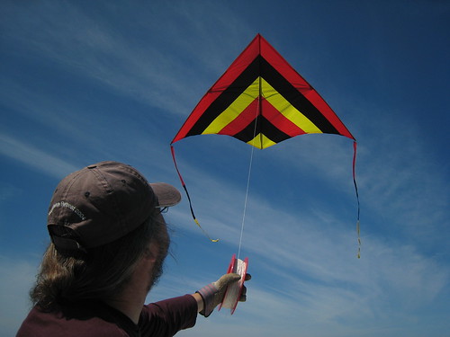
Fly high, as high as you can fly, fly that high, and then higher.
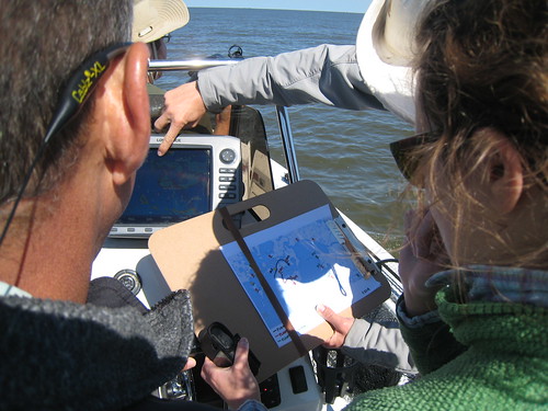
If there is little-to-no wind, you can:
A) Be a kite cowboy-or-girl and send up a kite anyway and tell the boat captain to gun it, or
B) Use a gall-darn balloon.
We chose option A because we are kite cowboys-and-girls but you, the rational PublicLabber, should probably choose option B. Choose option B and then refer to #1 above.
Don't forget to put a tail wing on your flying apparatus. We forgot, but still got some great pictures. More soon. We're back out there tomorrow.
Patti Smith says: "Because the kite belongs to lovers."
Jordan, Dan NOLA, Alex S, Matt P, Andre Lyon
https://www.flickr.com/photos/eustatic/sets/72157644325800766