How Grassroots Mapping Got Started: An Intro to Barataria Bay
An introduction to the Barataria Bay Project. This is an excerpt from our forthcoming publication 'DIY Aerial Photography of Barataria Bay: A Community Atlas'.

Image Credit: John Amos, Deepwater Horizon Oil Disaster June 22, 2010, Dr. Oscar Garcia
After the 2010 Deepwater Horizon explosion, a group of concerned individuals, representing Gulf Coast nonprofits, universities, community organizations, and impacted industries (such as fishing), came together in search of a solution. In the wake of the disaster, a flight cap of 3,000 feet had been placed over the Gulf making it difficult to capture images of the disaster.

Grassroots Mappers walked and boated the Gulf shorelines to launch “community satellites” (5.5 foot helium filled balloons and kites with basic point and shoot cameras attached) up to 2,000 feet in the air to capture pictures of the disaster as it unfolded.

Over the course of the disaster 100,000 images were collected, 100 miles mapped, and over 200 people involved. The maps of the disaster received broad media coverage, including features in the New York Times, BBC, PBS, and the Boston Globe, allowing residents to speak their truth to the world about what was going on in the Gulf Coast Region.

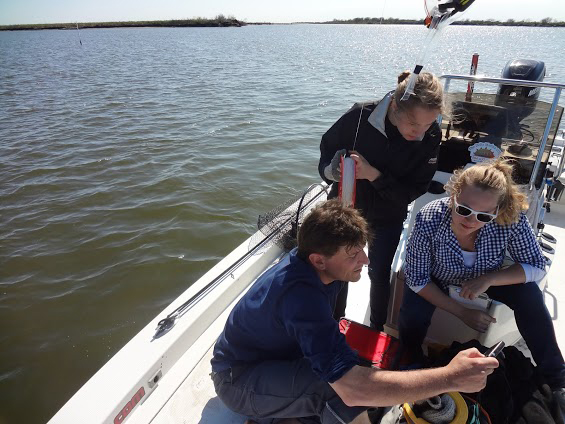
During 2011, Public Labbers hitched boat rides out to Barataria Bay with Louisiana Universities Marine Consortium (LUMCON) to capture aerial images at twenty sites researchers were testing. These sites had been classified as High, Medium, Low, and None for oil contamination based on SCAT (Shoreline Cleanup Assessment Team) reports.

Public Labbers returned to Barataria Bay in 2013 to map the region. Located 40 mile south of New Orleans, the Bay received varying amounts of damage from the oil disaster. Systematically monitoring these sites over time provides valuable ecosystem-wide information on their recovery.

Barataria Bay is locally essential as fish habitat, water denitrification and storm buffering for millions of Gulf Coast residents, and globally important for sequestering carbon, and sheltering migratory birds.