
For those who are comfortable doing their map stitching in Photoshop, but for whom the GDAL tools for creating an online version of that map (a tileset) are a bit overwhelming, it does work to just take your Photoshop map and upload it to Knitter: http://cartagen.org/maps
Here's an example:
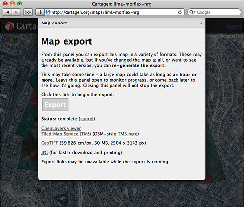
http://cartagen.org/maps/lima-morflex-nrg
then i pressed Export in the upper right corner, and it generated a GeoTiff (a geo-tagged Tiff), a TMS tile service, and an OpenLayers viewer:
http://cartagen.org/tms/lima-morflex-nrg/openlayers.html
This makes sense because Knitter is built on GDAL -- however, it can be a much easier interface for creating all the export formats.
It's also just a great way to share your maps online -- sometimes if you send a link around to a gigantic TIFF file you made in Photoshop, it crashes peoples' browsers when they try to open it... yikes.
0 Comments
Login to comment.