This is the first of a series of interviews we've conducted with mappers involved in documenting the BP oil spill. It is cross-posted at Grassroots Mapping
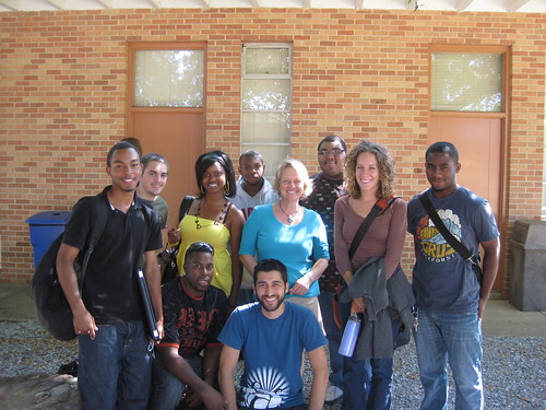
Dawn McKinney, of Mobile, Alabama (pictured above center in blue shirt)
What locations did you map?
Dauphin Island, a barrier island off the coast of Alabama at the mouth of Mobile Bay, near the former "Sand Island" and the public beach and Helen Wood Park in Mobile Bay.
What do you do?
I am a Senior Instructor in the School of Computer and Information Sciences (CIS) at the University of South Alabama in Mobile. I teach the object-oriented programming course for Computer Science majors and the Freshman Seminar course for all incoming freshmen to the School of CIS. I am also Co-Director of South Alabama's Center for Academic Service-Learning and Civic Engagement and on facebook.
How did you become interested in Grassroots Mapping?
I got involved in discussions about the Gulf Oil Spill Disaster and was made aware of this opportunity for the freshmen students to participate in a semester-long project where they could work in teams to explore their majors, establish relationships with other students, and connect to their community.
What was your most memorable experience while leading a trip?
Walking along the shore of the Gulf of Mexico with students and getting to know them away from the classroom.
Any suggestions for future trip leaders or Grassroots Mapping in general?
Pay more attention to the wind conditions in order to plan for problems better. Plan enough trips on varied dates and times which give all students an opportunity to participate. Have at least 3 trips throughout the semester. Give the students a "final goal" to reach so they have something to shoot for and so they know when they have succeeded. Give the students more background information about the environment in which the mapping is taking place and have them reflect more on the purpose, benefits of the experience for both the students and the environment.
Why do you think mapping the spill is an important environmental monitoring technique?
It gives every day people an opportunity to participate in something which could have a large impact on the community. It also connects people and at least gives them an awareness of their environment and how it changes. Probably most important is that it empowers every day people.
Anything else?
GM was an incredible resource for us and did an outstanding job of working with the students.
0 Comments
Login to comment.