Hold the showers:
April pole mapping brings May... wetland maps!
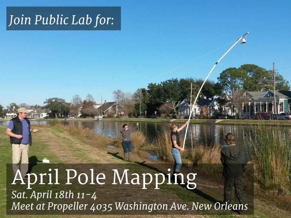
Where: Meet us at Propeller When: Saturday, April 18th at 11am. Why: We've been working on building a better pole for pole mapping. (Follow our work by clicking the polemapping tag, and others who have been on this quest as well!)
At this event we will bring our new, improved pole into the field for testing, experimenting and mapping. Also, we'll have a sneak peek at a NEW pole that could be coming to the Public Lab store! Will it be as awesome as ours?! Lets find out.
Plan on traveling to the South Shore Marsh Restoration Site and possibly revisit Bayou St. John's Scenic Urban Waterway with us.
I'll bring the snacks, you bring your sneakers! Questions, ideas, comments? Email stevie@publiclab.org
2 Comments
Hey Everyone,
I am a graduate student at the Harvard Graduate School of Design. I saw this posting and got very excited.
Last semester, my colleague VIneet Diwadkar and myself tried deploying a similar method of using a pole to map the Bussey Brook Bed Stream at the Harvard Arboretum in Jamaica Plain, MA. We produced a research paper for a class taught by Prof. Peter Del Tredici, former Director of Living Collections and Senior Research Scientist at the Arnold Arboretum.
We used the images captured by the GoPro to make 3D point clouds. One of our conclusions was that in order to better map the stream in 3D we need a higher rod that can produce higher overlap between the images.
Here is the research paper with out findings:
https://docs.google.com/document/d/1HXDU2u8xr4R2TSYMttNKnA-QUJ7089l-j9F59TSsGTA/edit?usp=sharing
If you do not have time to go over the paper, here are our summarized findings:
-The Bussey Brook stream was scanned wherever there was foot access to place the camera within direct sight of the stream. -Our method produced higher resolution color point clouds when compared with the NOAA Coastal Lidar and the UAV of the Hemlock Hills. -However, the point clouds produced had low degrees of internal correspondence, high degrees of distortion on the edges, and low degree of geolocation accuracy due to a low resolution GPS. -Future development should help improve the methodology that can support decision-making ability by personnel at the Arnold Arboretum in managing and intervening within current challenges at the Bussey Brook Stream.
Looking forward to new developments for pole mapping...
Best, Héctor
Is this a question? Click here to post it to the Questions page.
Reply to this comment...
Log in to comment
Hi Hector! Thanks for the post!! If you're not yet, you should follow the #polemapping to be sure to get updates when anyone on Public Lab posts about it! (http://publiclab.org/tag/polemapping) -Stevie
Reply to this comment...
Log in to comment
Login to comment.