
Latest and probably last in a series of maps of this site:
https://mapknitter.org/embed/more-updates-to-construction-site-near-mocho-park-livermore-ca
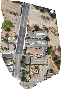
This is a follow up map done with Structure From Motion (SFM) (processing via WebODM), from over 500 photos taken with DJI Mavic Mini at ~50 meters above ground. Initial mapping this site was conducted with KAP from 2013-2014 as noted in: https://publiclab.org/notes/patcoyle/02-27-2014/more-updated-maps-construction-site-activities-near-mocho-park
Why I'm interested: The capability to document changes in our built environment and produce "map of the day" is a key benefit of the Public Lab tools.
0 Comments
Login to comment.