https://mapknitter.org/embed/el-naqab
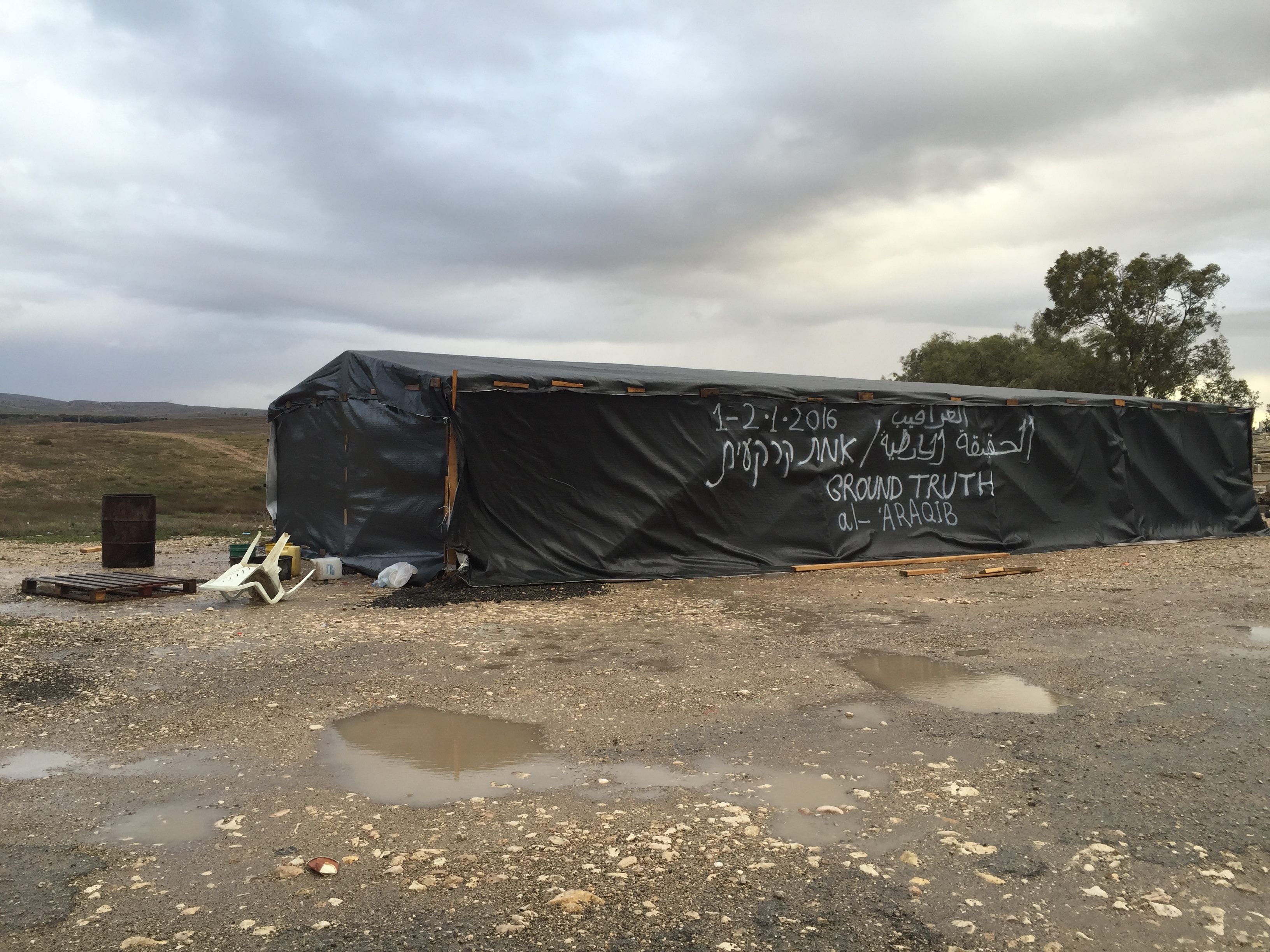
A three days event in the south of Israel, in the unrecognized Bedouin villages, that are frequently demolished by the Israeli authorities. Al Araqib, in which the event took place is a central node of the Bedouin struggle, after 92 demolitions in the past 6 years its residents are staying put. Aerial photographs are one of the most major tools for Al Araqib's residents to prove their presence on this land since more than a hundreds year ago. We worked with them for creating high resolution aerial photographs, as a process to document the village as it is today, detect the changes that occurred each demolition and reconstruct evidences of violence and destruction that are inscribed onto the land. The aerial photograph above is the first stitch, to be continued, of images taken under far from ideal weather conditions, on the last days of 2015, 31-1 January. The village's cemetery can be seen in the stitch, the only structures that are were never demolished. More details below
A 3D image (sparse cloud point) created by Ariel Caine that shows the kite's movements above the al-Turi cemetery:

Ground Truth: Testimonies of Dispossession, Destruction and Return in the Naqeb/Negev Al-Araqib, January 1-2, 2016
Exhibition | Launching: The Conflict Shoreline (Babel Publication) | Launching: Zochrot’s Truth Commission Report | Aerial Photography Workshop | Oral Testimonies
Zochrot and the inhabitants of Al-Araqib and the Forensic Architecture project at Goldsmiths, University of London organzied a gathering at the village of Al-‛Araqib in the Naqeb/Negev that will include the final session of the Truth Commission on the Events of 1948-1960 in the South. The events will be held in two tents built especially onsite. Given the recent and ongoing rejection of the Bedouins’ legal claims and the recurring brutal destruction of “unrecognized villages” such as Al-Araqib, we will examine the conditions for the production of truth in a neocolonial age through oral testimonies and memories, aerial photography, studies by Negev researchers and historical maps to offer an alternative conceptual horizon on civil society’s ability to re-appropriate its truth.
Curation and project management: Debby Farber
Together with: Eyal Weizman
Tent planning: The inhabitants of Al-Araqib together with Sharon Rotbard
Aerial photography workshop and exhibition: PublicLab:Jerusalem, Hagit Keysar, Ariel Caine
Archival Documentation: Miki Krazman
The project is a collaboration with Sheikh Siah Al-Turi, Aziz Al-Turi, Salim Al-Araqib, Ahmad Khalil Abu-Madighem, Awad Abu-Farih, Nuri Al-Uqbi and all the inhabitants of Al-Araqib.
1 Comments
This is an amazing project Hagit. You all might know of or be interested in the three-volume Inuit Land Use and Occupancy Project, which 'pioneered the use of individual map biographies. In these, ‘‘hunters, trappers, fishermen, and berry pickers mapped out all the land they had ever used in their lifetimes, encircling hunting areas species by species, marking gathering locations and camping sites – everything their life on the land had entailed that could be marked on a map.’’' (quote from Critical Cartography by Denis Wood & John Krygier)
Reply to this comment...
Log in to comment
Login to comment.