What I want to do
Capture the river restoration of Bayou St John on mapknitter from a public doman video screencap
Educate the public on the restoration of Bayou St John as historic and scenic urban waterway.
Show that helicopter photos can be used for maps, although there are the usual constraints.
Develop a Passenger Pigeon for small helicopters? of unknown focal length and camera...
Mapknitter can even help drones.
My attempt and results
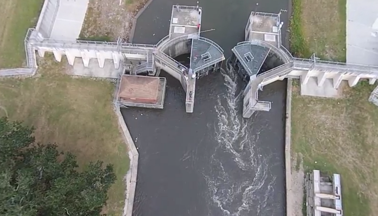
On 11 Nov, i was monitoring the water flow drawdown through wetlands, over the Lakeshore Dr Bridge, but LSU SeaGrant had contracted a helicopter to video the event of the gate opening.
One Sector Gate was opened halfway for an hour. Engineers for the Flood Protection Authority that manages the gates wanted to calibrate floodwater / river restoration models for bayou st john as part of its habitat plan, developed as part of the Scenic Rivers Act. The city has subsided, and the Lake flows into the Bayou, the Bayou drains into the (subsiding, even more leaky postK), municipal pumping system that keeps New Orleans dry.
Although the Bayou is behind a levee inside New Orleans, it's necessary to pulse opening the gates so that the water doesn't come too quick or for too long. But the force of the water is important for ecological processes, to a point. Engineers are working on models that would balance the flood protection and restoration missions of the sector gate operations.
I made a screencap of a youtube video that SeaGrant Posted under the standard Youtube License. I'm unsure what happens when Public Agencies use standard licenses like this, but i assume that the IP is Public Domain because I paid for it via taxes, and generally these things are distributed on platforms like youtube for public education. SeaGrant would probably get audited by Congress if they spent time developing an IP policy. #cynical
LA SeaGrant
I didn't get the helicopter specs, but i rain the Distort through GIMP (-41 main 5 edges). edges were still a bit wonky in the mapknitter. obviously -41 5 isn't the best.
Mapknitter
##Cartography Collective file
Questions and next steps
Is there a standard wide angle helicopter camera of known focal length?
i need to run this by Jessi Breen, Al Shaw, Brian, or @gonzoearth Stewart.
Why I'm interested
All your drone are belong to us
1 Comments
If its the same multi-rotor (helicopter) they are using in one of their older post, its a DJI Phantom or similar variant. Check out the shadow in the video (http://youtu.be/rJUjECTn1Mo?list=UU-1IsBy0qIe06s1lOGZLifQ) at ~1:30. Looks like GoPro footage if that helps too.
Is this a question? Click here to post it to the Questions page.
Reply to this comment...
Log in to comment
Login to comment.