What I want to do
June 27-29, 2014 The Tar Sands Healing Walk is a 16 kilometer spiritual walk around a former tailings pond in Fort McMurray, an oil boom town in northern Alberta, Canada. This was the fifth and final year of the walk. I was interested in kite mapping the walk and test out how useful kite mapping could be in a protest or march setting. I wanted to map the movement of people during a live event, in addition to the environment they are walking through.


My attempt and results
This was my first time doing a kite mapping on my own so I was feeling a littler nervous. Fortunately, I made some friends at the walk who were interested in helping out. The night before the walk, we sat on the edge of Gregoire Lake and worked on building the housing for the camera. I modeled my version after one that Eymund very generously gave me.
Here is a tailings pond, part of the Syncrude site. It looks almost like a naturally formed lake in the wild, but it is actually a former mining site, now filled with the highly toxic watery refuse created from separating the bitumen (oil) from the sandy, clay earth. Crudely made scarecrows, wearing bright orange jumpsuits dot the surface of this deadly lake, to scare off any unfortunate birds that might mistaken it for a lake and attempt to land.

On our 16 kilometer walk, we passed by these active extraction operations. The air was heavy with an asphalt smell, which you quickly stop noticing, however, a dull, steady headache begins to set in after several hours walking under the hot sun.

The weather was hot and dry on the day of the walk, with no sign of wind. I attempted to fly the kite at the start of the walk but after repeated failed attempts, I gave up and decided to join the walk and take photos from the ground. About 2/3rd of the way into the walk, the wind picked up and I tried again. The kite went up quickly and worked really well! But, I had accidentally launched the kite during a prayer ceremony--when photography is not allowed--so I had to pull the kite down, after maybe 5-10 minutes of mapping.
Images I managed to capture:

People sitting down to rest at one of the 4 or 5 prayer ceremony stops we made during the walk.

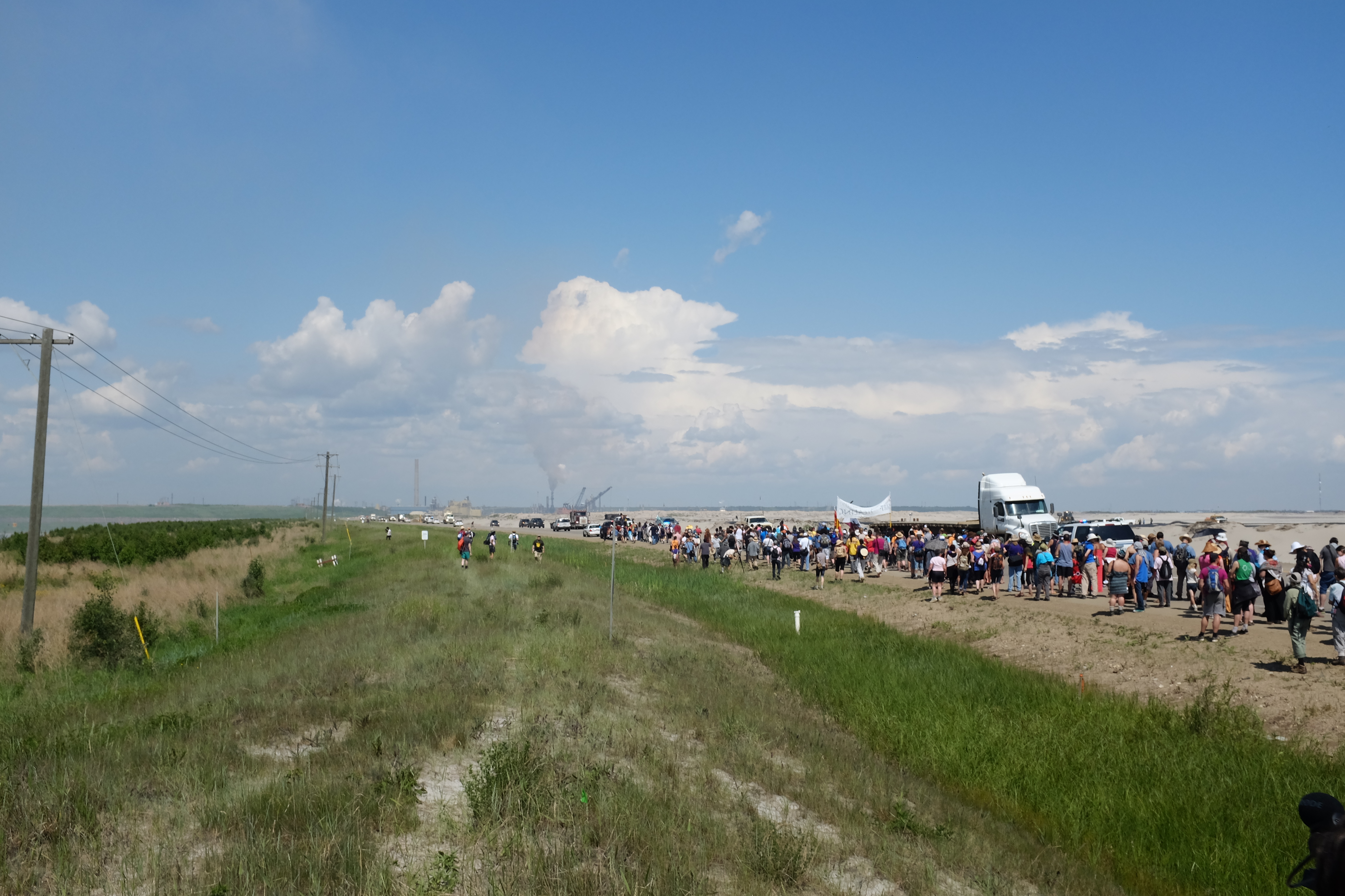
Here you can see some walkers holding a banner.

There were police cars following from behind to keep the entire party together. You can see part of a tailings pond off in the top left corner. The wind was really swinging the camera, which is how I managed to capture these blurry photos of the ponds.

Here you can see the flatbed truck holding some people and supplies.
Questions and next steps
This attempt may have been more successful if I also had a weather balloon kit set up to go, so that I could handle different types of weather conditions. I was also interested in mapping the tailing ponds and oil mining operations in addition to the walk, but was unable to do so. I would like to return to Fort McMurray and see if I could do another mapping, this time of the tailings ponds and mining operations.
Why I'm interested
The images collected from this event will eventually make its way into a mapping storytelling project I am currently working on, that will follow the proposed path of the Enbridge Northern Gateway Pipeline. I am interested in using citizen science, collective storytelling, and community-based efforts to create a multimedia documentary of the communities that will be most impacted by the development of this oil pipeline.
0 Comments
Login to comment.