Aerial Mapping Project: Biodiversity Mapping of the Diamond Hitch Vicinity
Partners: Adam, Eric, Gaby
May of 2017, The Thacher School
Introduction
We set out to examine which plant species comprise the biodiversity of the Diamond Hitch area on Thacher's campus. Our question: which plant species make up the biological composition of the Diamond Hitch area? We went into our project knowing almost nothing about the area we chose to examine. Eric conducted a long-term observation project on an area above where we were examining, and his experience was pivotal in our selection of our location. Aerial Mapping was an advantageous approach to this issue because it allowed us to gain a bird's eye view which was advantageous as it allowed us to cover more area than on foot and it gave us access to areas far from a trail ultimately allowing us to find species of plants that were present. From the photos we took, we were able to closely analyze and identify various plant species.
Our project is important because it contributes to our overall understanding of plant biodiversity at Thacher. Thacher has a vast campus of over 400 acres and sits on the border of the Los Padres National Forest, so it is more-or-less a hotbed for biodiversity. Documenting plant biodiversity would add to our growing knowledge of the natural landscape that we use on a daily basis either with hiking, horseback riding, or merely sitting outside.
Methods:
We used a Canon PowerShot A490 camera when taking pictures of the Diamond Hitch area. This area is located on the upper campus of the Thacher School in Ojai, California. We made sure we adjusted the settings to take continuous, high resolution, and large images that allowed us to take many photographs.
We made a housing out of the top of a 60 oz Ocean Spray PETE bottle, rubber bands and string to protect the camera during flight. Here is the link to the instruction on the Public Lab site: https://publiclab.org/wiki/soda-bottle-rig. We positioned the rubber bands onto the camera to stabilize it in the rig then tied strings to the camera to pull them through the bottle top. The string went through the bottle top as we attached a carabiner to the strings that eventually joined with the black ring, positioned on the balloon. After we had fixed the camera onto the balloon we used a similar method to connect the string from the reel to the balloon. We used another carabiner to connect the string from the reel to the balloon. After filling the balloon with helium we trapped the air in the balloon by positioning zip ties at the base of the balloon, tying two the base and tying one more to the base after folding it over.
After blowing up the balloon and attaching the camera with the contraption and the string from the reel we made sure to unravel the reel before walking out. We still held the balloon, not letting it up but we found that when we pre-unravelled the reel, the balloon climbed in altitude faster and in a straighter path. We did not let the balloon go till we reached our destination which was located around 100 yards from our initial starting point. After letting the balloon go we walked at a normal pace letting the balloon climb higher and higher. After arriving to our final destination which was located around 200 yards from our initial starting point, we sat down and let the balloon take pictures of the area at its maximum height. After around five minutes at our final destination we reeled the balloon back in and walked back to the van.

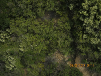
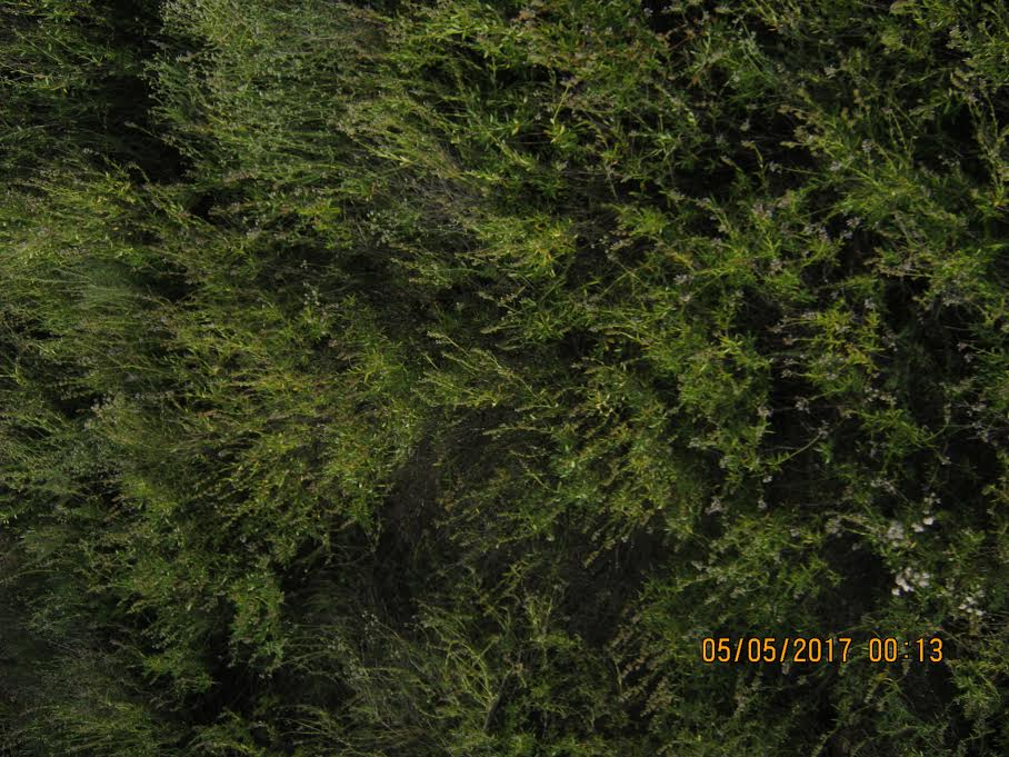
Biodiversity existing within the Diamond Hitch area

Results:
By checking the settings and focus of the camera before the first balloon launch, the resulting pictures were clear, and some of the plant-life of the Diamond Hitch area was easily identifiable. However, due to insufficient helium and because we unravelled the balloon too slowly, the pictures were taken at close proximity and therefore did not capture a broad scope of the plant biodiversity at Diamond Hitch. During our second trial run, we unraveled the string completely prior to moving; the results proved more effective in capturing a broader range of territory as the balloon reached a higher elevation in a shorter amount of time. Additionally, the balloon did not sway back and forth as much, making it easier to identify the areas where plant types differed, as well as shortening the time necessary to run the trial. However, as we failed to ensure that the appropriate camera setting was in place, the brightness of the photos produced made it difficult to distinguish and identify the plants.
What did we learn?
We learned that we pre-unravelled the reel attached to the balloon the balloon rose in a straighter path. Also, we learned that by letting the balloon go at our destination instead of letting it slowly rise while we walked to our destination proved more beneficial because the balloon and string had less chance to be caught on a branch. Next, we learned that when the balloon is too high in the sky the pictures are often too bright and blurry to show the biodiversity. This could have been due to the fact that our camera settings were wrong but we made sure to double check the settings before we launched the balloon. Finally, by creating a contraption that holds the camera in a sturdy position it allowed us to have clear pictures that were unaffected by the wind. Another aspect that should be mentioned is that this process was a give and take process in that, height can be advantageous in analyzing more plant species however, the images become more granular and more difficult to recognize so there's a sweet spot to be found.
Recommendations:
Based on our own experiences, we recommend utilizing a camera setting that is not as sensitive to glare. We recommend others to double check the focus and the lens quality of the camera prior to launching the balloon to produce usable pictures. For future aerial mapping runs, we suggest making sure that a sufficient amount of Helium is used to fill the balloon, so it does not unexpectedly come down. Launching the balloon on a day when there is minimal wind could be a beneficial change for future balloon aerial mappers as it affected the quality of our photos and made it difficult to capture images solely of our intended area. The height of the balloon was critical in determining the biodiversity of the Diamond Hitch area; for other groups running this experiment, we recommend taking pictures at different heights (both high and low), as it enables a more accurate overview of the biodiversity in the location by providing different perspectives. We do recommend however, taking more pictures from higher locations as this gives insight into where each plant type is located in the area. Closer images give a limited view of the amounts of a certain plant type in an area and make it hard to identify the dominant plants. A strategy we recommend is to launch the balloon before running the experiment as this reduced uncontrolled movement of the balloon, prevented the balloon from getting stuck in trees, ensured that the pictures taken were of a linear path, and saved us a lot of time. It also enabled us to have a broader perspective of the area as the balloon was able to reach higher elevations. We also recommend investigating the plants native to the area, before running the experiment, as this would be useful when identifying the plants from the images taken.


0 Comments
Login to comment.