This is Part 2 of an ongoing series of case studies by Gretchen Gehrke, Public Lab's Data Advocate, highlighting different stories of environmental data's use in the Public Lab community. You can find the entire series here.
Ecological assessments and management strategies often require a combination of landscape-scale visualization and individual plant-specific documentation. Low-altitude high-resolution aerial imagery can be used to collect and distribute information on both of these scales. Community members have utilized Public Lab balloon mapping kits with a red-green-blue (RGB) and near-field infrared, red, green (NRG) filters to plan and monitor ecosystem services such as invasive species eradication and wetlands restoration projects.
Strong winds and salt water intrusion during Hurricane Katrina destroyed bottomland hardwoods in southern Louisiana in 2005. On the 86-acre Audubon Louisiana Nature Center property (above), nearly 90% of the bottomlands were uprooted and rapidly repopulated by the invasive species Triadica sebifera, known as Chinese Tallow. In order to help restore the natural ecosystem, Disaster Recovery Coordinator Amy LeGaux first needed to determine the extent of tallow infiltration over many acres, and used aerial images to do so. LeGaux and colleague Scott Eustis of the Gulf Restoration Network flew kites equipped with RGB-lens camera to visualize the area. In 2015, the Audubon Louisiana Nature Center property still had 52 acres of tallow, and the Center received funding to remove 14 acres of the invasive plant. Using NRG aerial images Eustis collected using a Public Lab Kite Mapping kit, they were able to distinguish tallow from any surrounding vegetation due to its high photosynthetic activity, and LeGaux could make a detailed geographic plan for tallow removal. Using aerial images was more efficient than canvassing tree species on the ground, and facilitated strategic planning with tallow removal by maintaining a more comprehensive scale than is accessible on the ground. Aerial images have also been useful in documenting restoration progress and educating the public with compelling visual evidence about invasive species progression and eradication.
Other invasive species management programs by city and state departments have planned to use Public Lab Balloon Mapping kits for reconnaissance to collect information about the geographic extent and severity of invasive plant establishment. A collaborative effort between University of Massachusetts at Amherst professor Charlie Schweik and personnel at the Fish & Wildlife Services developed a plan to use aerial images to map water chestnuts in a series of ponds in Westfield, Massachusetts, which had previously been painstakingly canvassed by personnel in canoes. The team attempted to do Supervised Classification of the image pixels, using R, G, B, and IR bands in order to discern water chestnut plants from surrounding vegetation. Unfortunately, weather conditions, including a large wind gust leading to a dunking of one of the cameras, impaired the student team’s ability to collect four-band images over the land area of interest, so the aerial images were not actually utilized in the water chestnut management plan. However, there is potential to utilize the sophisticated techniques such as supervised classification in do-it-yourself remote sensing, which makes those techniques available to resource-limited city and regional ecological organizations. With high resolution cameras, appropriate filters, and stable flying conditions, it may be possible to do spectral analyses, which could be useful for a variety of applications including species identification and temperature differentiations. An advantage of being tethered to the mapping unit, either kite or balloon, collecting images throughout the ascent, are the multiple scales and resolutions of emergent photographs, which then can be useful for a variety of applications.
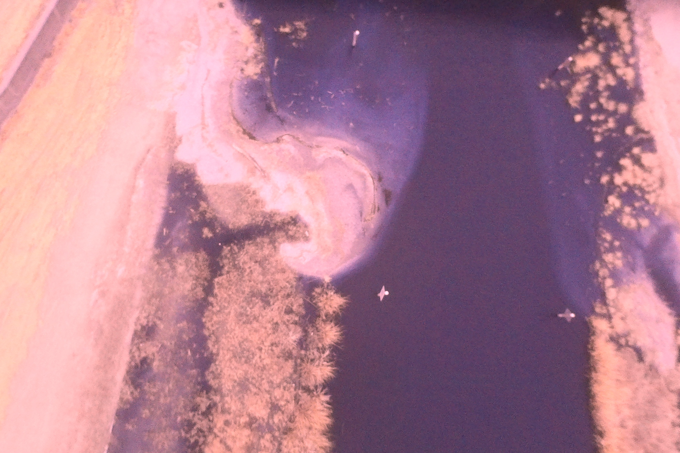
Aerial imagery is useful in planning and monitoring ecosystem restoration projects. The Lake Pontchartrain Basin Foundation has developed and implemented wetlands restoration programs throughout the Lake Pontchartrain watershed, including a marsh-creation project in Bayou St John spearheaded by wetland biologist Andy Baker. Andy and colleague Scott Eustis have used Public Lab kite mapping kits to collect a long-term time series of RGB aerial images along Bayou St John, first to determine the appropriate scale of restoration, and then to observe plant growth and channel migration, and highlight potential problems. Aerial images documented the migration of excess dredged material into the new marsh area, and the effectiveness of corrective measures. The time-series of aerial images has demonstrated differential growth patterns along the two shores of the bayou, which has implications for future restoration programs.
For ecological assessment and monitoring, temporal and spatial resolution are important. Various applications will require different degrees of data resolution, both on a per-pixel basis and over time, and it is important to incorporate those data needs into the mapping campaigns. If resources are available, it may be beneficial to use high-resolution cameras with a variety of filters to monitor aspects such as sub-aqueous vegetation with aerial photographs, or adapt the mapping kit with a remote trigger would allow the user to select when to capture a photograph with the balloon or kite flying. With a basic Public Lab kit focused on ease of use, individuals and communities can choose to make modifications to improve resolution in time and space that would enhance the utility of do-it-yourself aerial mapping for ecosystem management.

Audubon Louisiana Nature Center Image by stevie

Water Chestnut (invasive plant), Westfield, MA Image by atvolpini

Infragram of Bayou St John, Louisiana Image by eustatic
0 Comments
Login to comment.