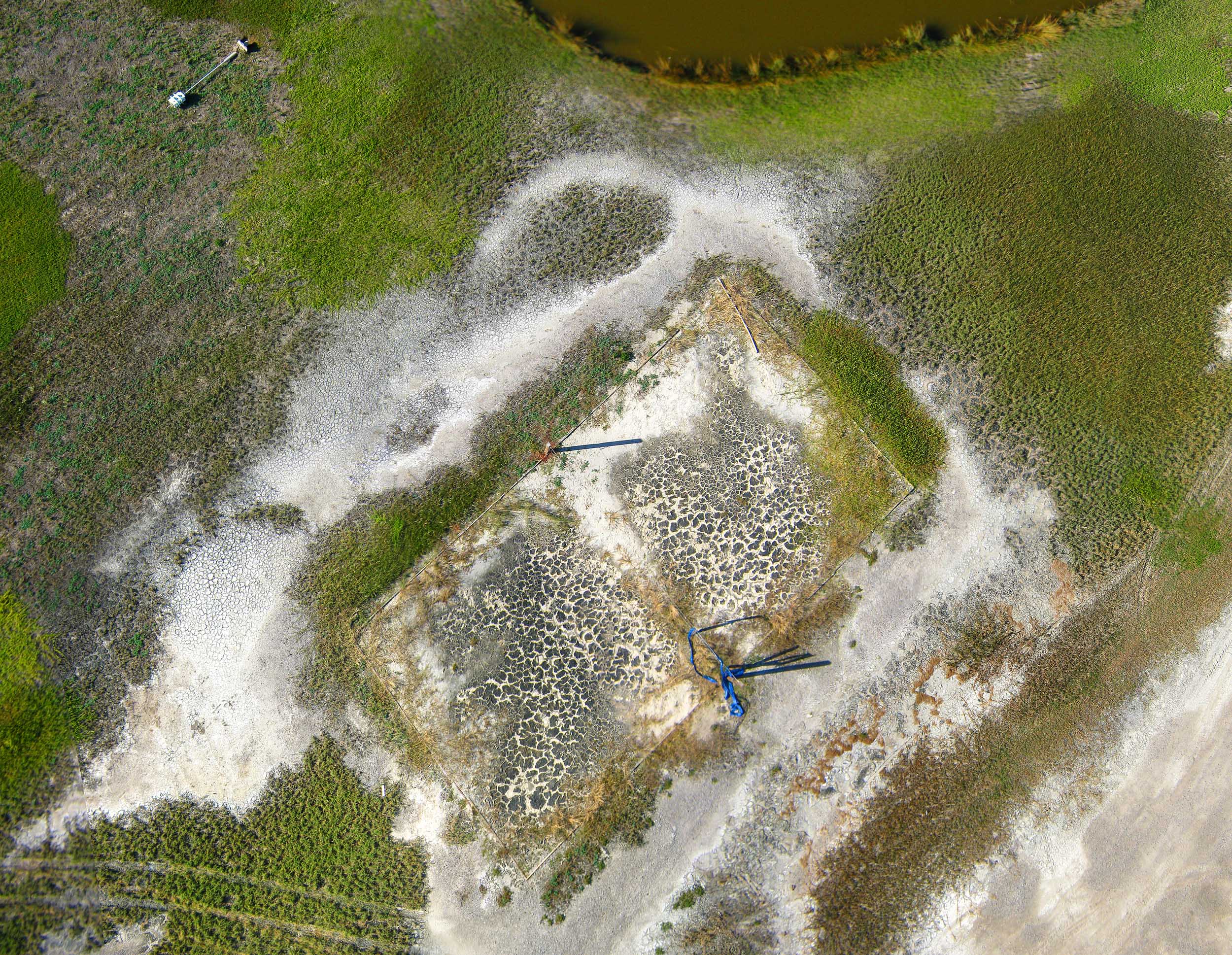
Image above: The LUMCON volleyball court in Cocodrie complete with dessication cracks in the cryptogamic black crust. Stitched from six KAP photos.
After the Barnraising in Cocodrie in 2012, a couple of orthomosaics were produced from kite and balloon photos. I posted a big stitched RGB image from a dual camera rig flown over the LUMCON DeFelice Marine Center. I also stitched together some of the false color infrared and NDVI images, but I still haven't done them all. In anticipation of visiting Cocodrie this week for the Barnraising, I did a little more stitching and made a poster to take along.
If you can't wait until we get there (or if somehow you decided not to attend) you can see the poster in high resolution below. The printed poster I am taking is four feet wide, but if the image below were printed 10 feet wide you wouldn't be able to see the individual pixels (the horizontal resolution is almost 30,000 pixels).
The gigapan embedded below can be seen here: http://www.gigapan.com/gigapans/165479/
I don't know enough about the plants growing around LUMCON to use these images to make a vegetation map. Maybe this year someone can help identify the key species and at the next Barnraising we will have a vegetation map overlain on this image. Or better yet, two images taken two years apart showing successional development of the lawn community.
This is the second time my suggestion to have a poster session at the Barnraising has been enthusiastically ignored, and also the second time I decided to bring a poster anyway. See you at the poster session.
1 Comments
Awesome!
Reply to this comment...
Log in to comment
Login to comment.