Rifle, Colorado
Mapped by Rick Roles, Stewart Long
Cartographer: Stewart Long
Published by gonzoearth
39.44507276015707 N, -107.71946472808528 E
177 views
Capture date: 2011-09-16T00:00:00
Publication date: 2011-09-26T00:00:00
License: Public Domain
Mapped by Rick Roles, Stewart Long
Cartographer: Stewart Long
Published by gonzoearth
39.44507276015707 N, -107.71946472808528 E
143 views
Capture date: 2011-09-16T00:00:00
Publication date: 2011-09-26T00:00:00
License: Public Domain
Notes
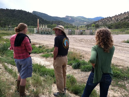
Rick describes the wells to Public Laboratory folks (Shannon and Sara) four days before the mapmaking -- on Monday.
Cartographer notes

While we mapped in the field it was raining and the conditions were drastically changing. It went from sunny, to spotty, to dark and back. These changes in weather resulted in a very diverse imagery collection from the flight and increased the difficulty in producing the map.
--Stewart
Notes
Rick describes the wells to Public Laboratory folks (Shannon and Sara) four days before the mapmaking -- on Monday.
Cartographer notes

While we mapped in the field it was raining and the conditions were drastically changing. It went from sunny, to spotty, to dark and back. These changes in weather resulted in a very diverse imagery collection from the flight and increased the difficulty in producing the map.
--Stewart

0 Comments
Login to comment.