Below is a half spherical panorama taken over the 1759 British Fort at Crown Point, New York with an infrared camera. The PowerShot A2200 had its IR block filter replaced with a piece of Wratten 15 gelatin, and a custom white balance was done before shooting. After finding 34 photos that stitched together into a panorama, I put those photos in Photoshop and converted them to false color infrared images. Those CIR images were then stitched together in Microsoft ICE and the panorama was uploaded to Photosynth.net. The only way to get a panorama at Photosynth.net is to do the stitching in ICE and have ICE prepare and upload the panorama for you. Then you can view it in the nice spherical viewer.
.
Microsoft retired Photosynth in February 2017.
Chrome no longer supports Silverlight which is required to view Photosynth embeds properly. For the full experience you can use another browser. Viewing the panorama at Photosynth helps a little.
.
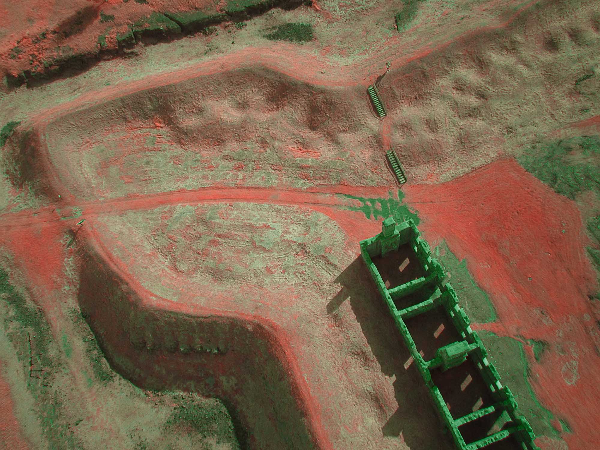
The CIR images do a good job differentiating healthy vegetation, sparse vegetation, dead vegetation, and non-vegetation. Bright red or pink is healthy vegetation. The rampart and collapsed banquette of the fort are too steep or rocky to mow, so string trimmers are used periodically to cut the grass and weeds. That had just been done, and the dead grass was lying on the ground. The light gray color is dead plants. Darker gray is bare rocks or roads. This image might have more reliable information about plant health than the NDVI image made from the photos. This is due to the artifacts introduced in the computation of NDVI and because much resolution is lost when NDVI images are made.
.

NDVI image of the stitched panorama. The recently mowed rampart and banquette have lower NDVI values than the lawn or uncut fields. Rocks, roads, and water have NDVI values below zero. This panorama was stitched from the photos straight from the camera and then the entire panorama was loaded into Fiji to make an NDVI image.
.
The camera flew under a Levitation delta kite on a Saturn V Rig with SkyShield autoKAP controller. This is a rig that is currently under development. There are a few research notes about it.
.

The PowerShot A2200 on the Saturn V Rig with SkyShield autoKAP controller.
There is more information about the development of this rig at the KAPtery.
2 Comments
Cool, the Photosynth viewer for Chrome is done in HTML5, natively - no plugin! Pretty neat.
Reply to this comment...
Log in to comment
Oh, that's what's happening. I wondered how it worked at all in Chrome without Silverlight support. In all other browsers you see overlays of zoomable "highlights" and some navigation tools, plus I think the panning is smoother.
Reply to this comment...
Log in to comment
Login to comment.