What I want to do
These are the Patagonia trips.
Organize them here.
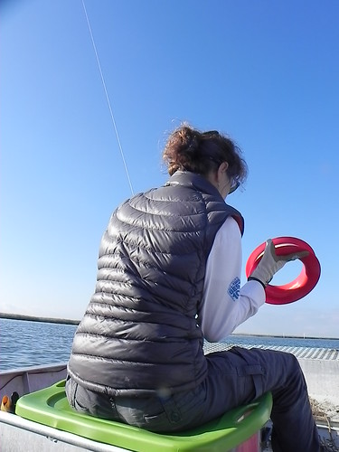
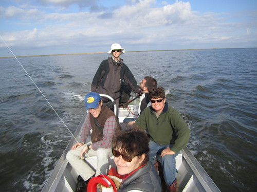
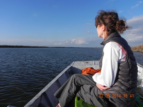
We sent out a doodle pool of likely participants, including Richie, a local, who supplied a mud boat. Richie came with his friend Chris.
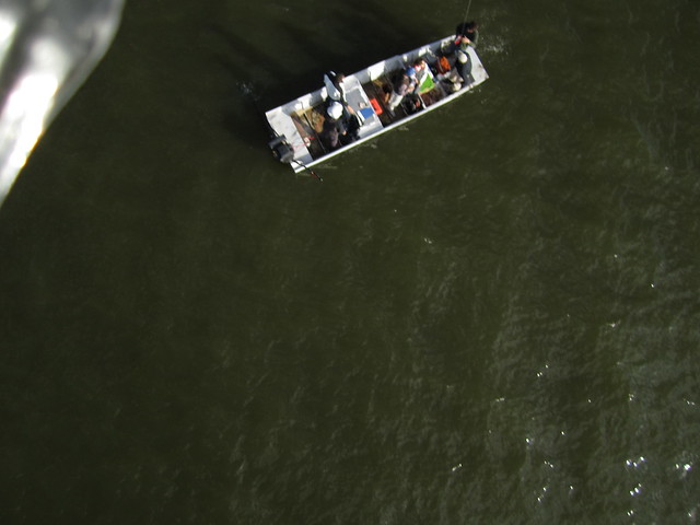
On Sunday 9th Feb 2014, Alex Stoicof, Paul, Scott, Matt P, Richie B and Chris launched out of myrtle grove marina on the most fabulous day ever invented.
KXPY
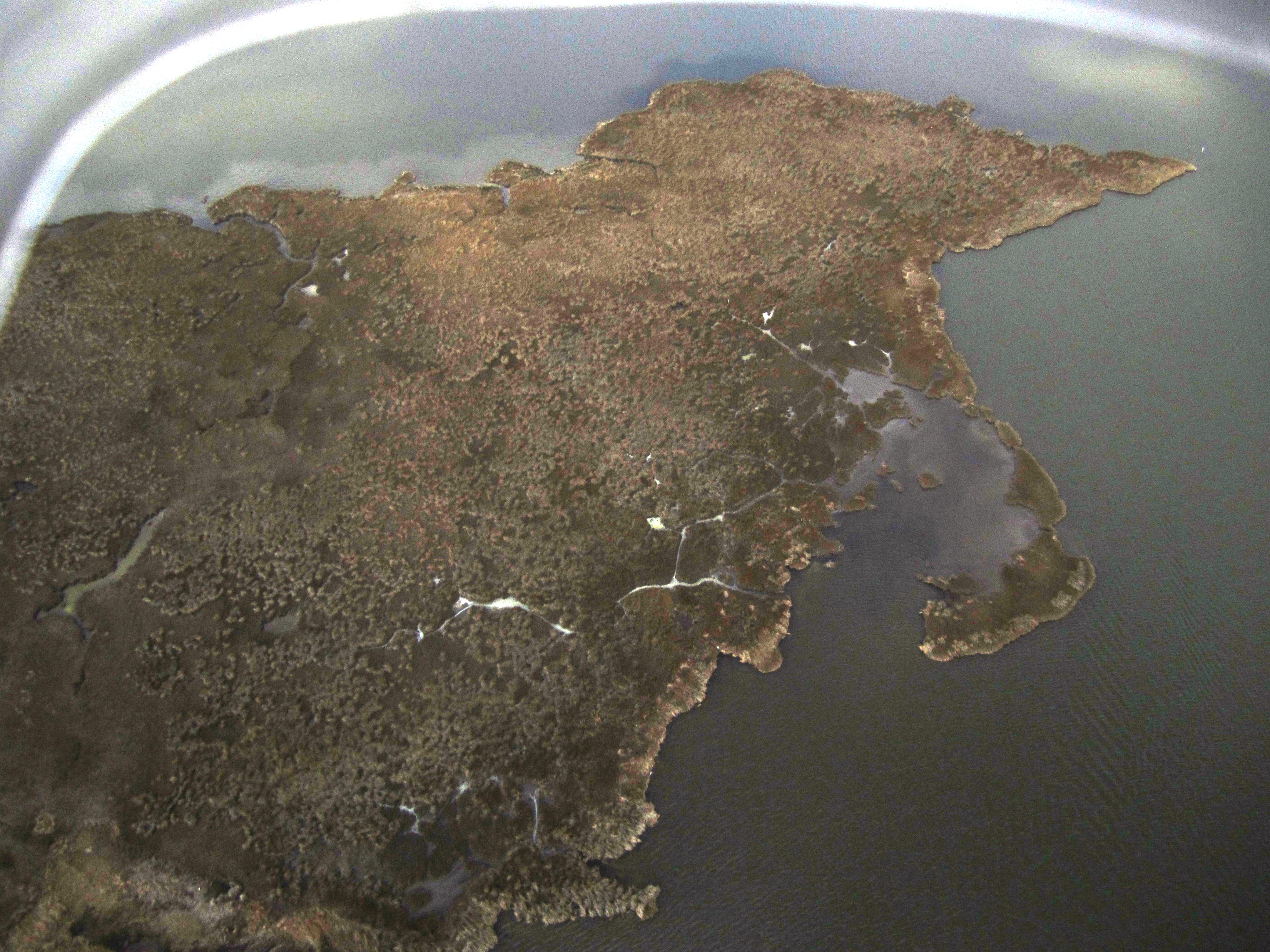
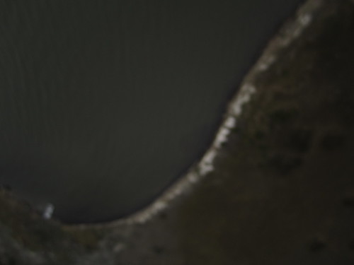
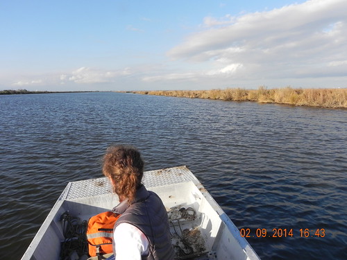
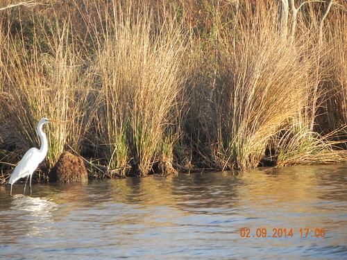
The tides were cooperating. The recent recurring North winds meant that tides were low enough that small spits of land showed 'Louisiana cliffs' of 2-12 inches.
Low tides ensure that the land / water interface could show clearly, and not be obscured by flooded marshes.
Predicted tides, Manilla Station: (29.4267, -89.9767)

Actual tides, Terrebonne Bay, courtesy of LUMCON:
https://stormcentral.waterlog.com/SiteDetails.php?a=57&site=2&pa=lumcon
My attempt and results
On the night previous, I drew 300m lines such that the points hit the midpoint of each line. I printed out loads of close up screenshots of the google earth map of the sites.
-10:14 am - Myrtle Grove Marina
Barataria Bay Mapping - PublicLab
Richie, Chris, Scott, Alex, Paul, Matt
-10:30 am - boat in the water
-10:45 am - left marina
~12:06 pm - cleared channel, @ BM1
on Captain’s advice, scrapped original plan to map western sites--stuck to sites close in, east of Wilkinson’s Canal.
~12:22 pm - @BL2
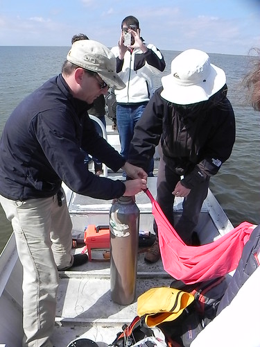
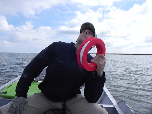
-rig weight = 0.52 kg (RC picavet)
-balloon pull (ed. “lift”) = 0.4 kg
Balloon was not filled, helium ran out.
-soda bottle rig = 0.2 kg
-therefore will use soda bottle rig instead of RC picavet rig
-lift on little bear 6ft falcon delta kite = 1.1 kg
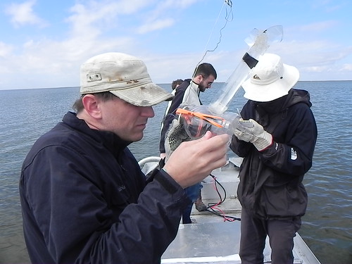
A bit tongue is esstential for keeping the kite stable. :)
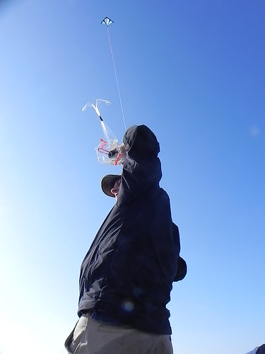
FIRST SESSION 1310 - 1338
-1:10p kite in sky
-1:15 pm - underway w/ kite in sky
-1:21 pm - finished BL2 transect
continued to backside of BH4
-1:35 (pm) - turned corner to put us on frontside of BH4 heading North
- dolphin sighting 2 dorsal fins
- 1:38p beached the boat south of BH4
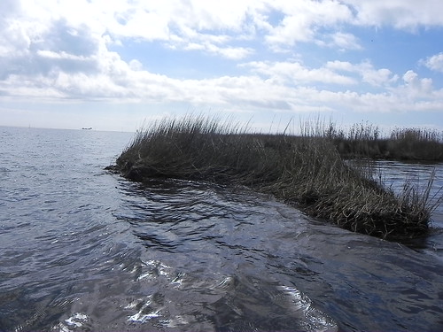
here, the low tide is visible, with lots of erosion

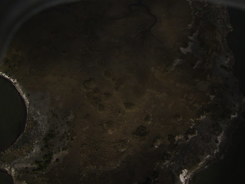
"Coffee Grounds"-- organic fibrous material, shows a very dark signature from the kite photo. often, this material collects in areas of gentler tidal action and should not be mistaken for oil.

Checked photos from first session --it appeared from the 1400 display that ALL photos were of water. later, on a PC, we could tell that they were just dark. Making a decision to fly BH4 and BL2 again.
first set: Water. Dark.
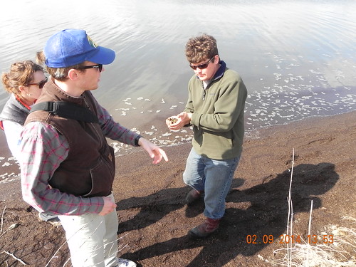
Richie collected some Mangrove seeds. Some mangrove looked scorched, had they been frozen by the recent visit of the Polar Vortex?
SECOND SESSION 1415 - 1507
- 2:15pm Kite in sky on land, in attempt to fly over BH4 site from land
-many Uca holes and Uca crabs scurry underfoot, burned Mangrove? --looks "burnt", having suffered from freeze? - 2:25 - 2:30 depart island, kite in sky, first headed north, then looped around to head east
- when we set off north we approached or even accomplished part of the BH4 transect
- 2:37 after heading east, swung N, then NW to draw closer to island to fly over BL2
- 2:42 parked boat, reeling in on other side of island from BH4
- about 6-7 large redfish jumping, Golden monsters.
- 3:07 reeled in, heading to BM2
second set: blurry. dang.
For the third set, white balance and focus were double checked.
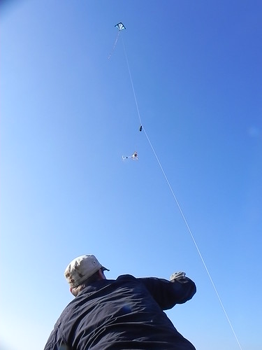
THIRD SESSION 1524 - 1554
- 3:16p stopped at BM2, flight prep
- 3:24p kite in the sky
- 3:26p kite in the sky w Canon 1400 and AMOD photo logger
- 3:54 kite + AMOD + 1400 landed, back in the boat and @ mouth of channel (Wilkinson canal)
For the third set, we were confident in the steady winds, enough to fly the AMOD tracker with the camera:
third set: amazing!
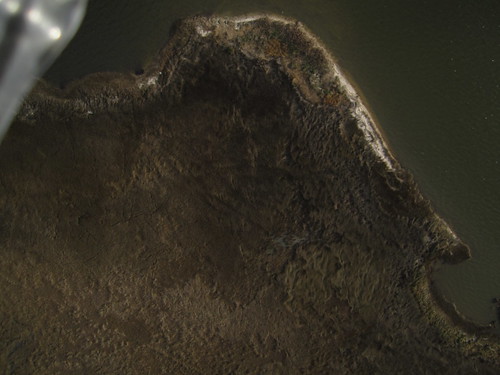
We travelled for a long while with the kite up for the third set, and got a lot more than the original 300m "must map" target shoreline.
The third set was the most satisfying, as the sun came out and gave us some wonderful afternoon light for mapping. We kept going west until we hit the channel, far exceeding the 300m "must hit" zone.
Questions and next steps
mapknitter placeholders: [to be done]
carto collective:
Second set is not in the Cartography collective document.
BL1 first set, dark: https://drive.google.com/folderview?id=0B32DNGN8pX_XdlY5b0oxVHpMeE0&usp=sharing
BH4 second set, lack of focus https://drive.google.com/folderview?id=0B32DNGN8pX_XWDFWc3l5alFlNlE&usp=sharing
BM2 third set: https://drive.google.com/folderview?id=0B32DNGN8pX_Xd1I4cTdnWld5MEk&usp=sharing
flickr:
https://www.flickr.com/photos/eustatic/sets/72157640862266313/
Why I'm interested
Simply put, mapping change in landforms over time
From an advocacy perspective, we want to track whether oil sites erode more than non-oiled sites. Sites have been given an array of treatments, most of which we will not know until the NRDA ends, lifting the USA's legal contest with BP. Until then, we use the ERMA data to tell us, at least, which sites were oiled, and which sites escaped the sludge.
Additionally, if citizens are out monitoring, there is more of a likelihood that sites that the Coast Guard is no longer monitoring will be cared for.
Barataria Wetlands are the beating heart of the Gulf of Mexico Ecosystem
8 Comments
Great field work. Tracks, timeline, ground images, and background story, this is a model field mapping expedition. It helps the cartography work better as well. Love the lead aerial image.
Reply to this comment...
Log in to comment
eustatic organizes. eustatic produces. eustatic inspires. just a thought: maybe add arrows to give a direction/order for the "track". regardless, i love that thing.
Reply to this comment...
Log in to comment
p.s. eustatic also needs a key to propeller :-)
Reply to this comment...
Log in to comment
you all are the best.
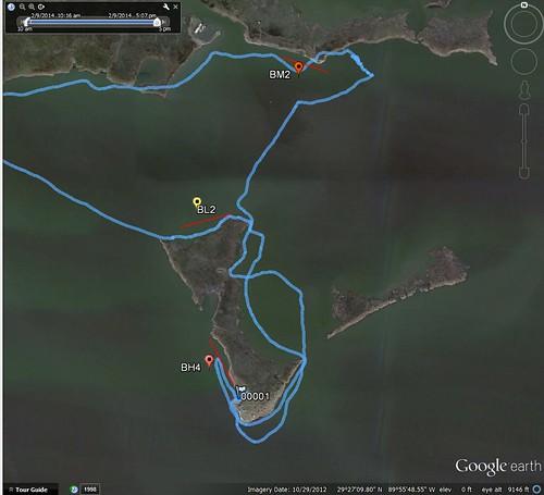
blue arrows= chilling, no kite photos
green arrows= first flight, dark, but on target. AMOD tracker on scott's person on boat. 0001 stopping point. kite retrieval
red arrows= second flight, out of focus. boo. AMOD on scott's person, on boat. second red arrow, kite retrieval point.
purple arrows= AMOD tracker attached to KITE, excellent third set photos, ran camera until we hit the channel, kite retrieval en route to the marina.
Reply to this comment...
Log in to comment
What the hell is an AMOD? cheapo photologger GPS, light, all the weight is in the AAA batteries
http://www.amazon.com/AGL3080-Logger-Windows-Software-included/dp/B000WO6HJW
all photos up on google drive should have a lat long in the .exif data, even though for the first two flights, it's not where the camera was, it's where the boat was....
also i realize i messed up a bit on that diagram... hold on
Is this a question? Click here to post it to the Questions page.
Reply to this comment...
Log in to comment
Reply to this comment...
Log in to comment
nice addition with the arrows, transects, stars/points. digging it. i'm travelling but will finish putting up the notes soon.
Reply to this comment...
Log in to comment
I beat cha to it :)
Reply to this comment...
Log in to comment
Login to comment.